M176 |
978 m. |
3209 ft.
Translation: Hill of the dog, or hill of the meeting
Pronuncation: konival
Beinn Dearg and Cona Meall May 2009 saw us hiking up Gleann na Sguaib twice. I described construction work going on the banks of the River Lael in another tour description (Eididh nan Clach Geala). Just let me mention that the surroundings were not super scenic until we left the forest road. It was a wet day and the weather got worse the longer the hike lasted.
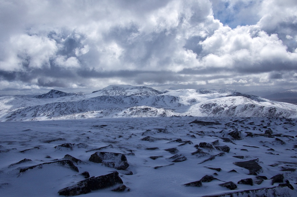
Once on the good footpath in Gleann na Sguaib we made good progress, enjoyed the view of the Eas Fionn and climbed up the three or four steps of the higher corrie. On the Beallach Choire Ghranda between the three Munros Beinn Dearg, Cona Meall and Meall nan Ceapraichean (climbed more than ten years before in February 1999 – stomping through lots of snow on the beallach and the slopes of Meall nan Ceapraichean) we were engulfed by clouds. Again no views! So we headed up the steep north ridge of Beinn Dearg following the stone dyke and crossing patches of old snow. Soon the flatter summit section of Beinn Dearg appeared and we spent 15 minutes at the summit cairn of M57. These were the last minutes without rain for hours.
We retraced our steps to the beallach and were lucky enough to be afforded a few minutes of relatively clear views of the way ahead to Cona Meall. Over the hillocks of the beallach we reached the grassy slope leading up to the summit ridge of Cona Meall. Higher up the slope and the ridge got quite stony. After slithering a few times on the wet slabs we reached the summit of the second Munro of the day. The weather being as it was (wind, rain, no views) we did not linger at the summit for long. On our way back we did stumble upon the path climbing up the last 50m of the headwall of Choire Ghranda. This path was very wet, good going was interspersed with lingering patches of snow and slippery stretches of earth and stone. But this too came to an end and we found ourselves back on the beallach. There we weaved our way around the small lochans, hit the path and then headed down Gleann na Sguaib.
Once on the forestry road I changed into a pair of spare dry socks – my feet felt I was walking on enormous blisters but it was nothing. Then, after a few more showers we finally got back to the parking at the A 835 in Inverlael. We stripped off much of wet clothes, changed into something dry and warm, exchanged a few mountain-wise words with an American hiker (whom we met again a few days later on Eididh nan Clach Geala) and drove off to Ullapool to buy some provisions. Another quite unappealing day on great hills with hardly any views. A test of our stamina and dedication to the task. We passed. Without problems. :-))
Description These two mountains have a splendid situation on opposite sides of Coire Ghranda in the southern half of the Beinn Dearg group to the north-west of Loch Glascarnoch. Coire Ghranda is a magnificently wild corrie with a dark lochan hemmed in by steep crags. Beinn Dearg is the highest in the group, a big stony mountain with impressive cliffs on its east face overlooking Coire Ghranda and on its north face above Gleann na Sguaib. Cona' Mheall is a more compact peak whose finest feature is its narrow south ridge which rises steeply above Coire Ghranda and gives an excellent route to the summit.The best traverse of these two mountains starts from the A835 road near the east end of Loch Droma. Go north across a low ridge to the west end of Loch a'Gharbhrain and continue north past Loch Coire Lair to reach Coire Ghranda. Climb steeply up the end of the south ridge of Cona' Mheall and traverse this fine narrow ridge to the summit. Descend west down boulder slopes to the wide col leading to Beinn Dearg. Climb this mountain up a stone dyke to the flat stony summit. Descend a steep ridge east then go south along the edge of the cliffs of Coire Ghranda, crossing a stony knoll and descending a wide grassy gully to lonely Loch nan Eilean. Cross the outflow from this loch and go down the north side of the Allt a' Gharbhrain to return to the outward route.