M56 |
1087 m. |
3566 ft.
Translation: Stonemason's hill
Pronuncation: byn a' claachar
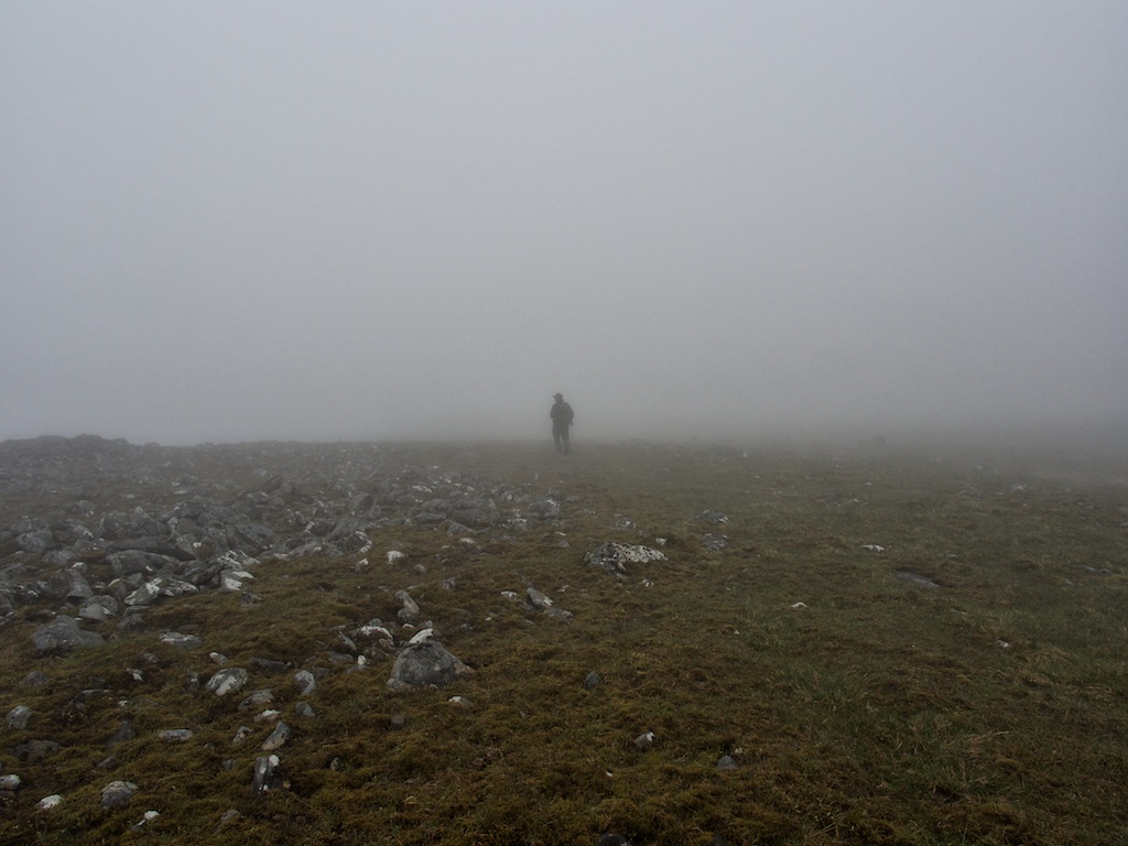
Gorillas in the mist? Well not exactly since there were no gorillas and we were not in Rwanda. But then: There was mist, there was the Moy Forest on the other side of the A 86, there were mountains all around. And there is a civilization encroaching on wild land in the form of forestry roads, hydro works and even the odd jogger on our route. But no Sigourney Weaver and no Diane Fossey.
Anyway. Years ago we had climbed Creag Pitridh and Geal Carn in quite appalling conditions. Strong winds, driving rain, no views. This time round we set Beinn a’Chlachair as our objective. We parked in the layby at the west end of Loch Laggan. Once outside the car we were attacked by midges, which meant a rather hurried start to the day.
We crossed the River Spean and took a left turn at the first fork of the forest road just before Luiblea. After a few metres a gate blocks the access to the Land Rover track on the right bank of the Abhainn Ghuilbinn. Once through the gate and on open land the Land Rover track climbs easily towards Lochan na Earba which is reached after maybe 45 to 50 minutes. On this track we were overtaken by a friendly jogger with whom we chatted a bit when we bumped into him again close to the Lochan. On the sandy shore of Lochan na Earba we took a break to drink and eat a muesli bar.
Refreshed we set our inner compass towards the bealach between Geal Carn and Beinn a’Chlachair. The climb beside the Allt Choire Pitridh is very comfortable since the path is well-maintained and easy to follow even in its upper section. Once at the Bealach Leamhain we decided not to climb towards the east ridge through boulders and over steep grass since the visibility was very restricted and route-finding might have been a real problem.
Much rather we followed the path over the bealach in the direction of the Allt Cam and Culra. Over the next kilometre the rocky path loses about seventy or eighty metres in height but the surroundings are interesting indeed. To the left is Loch a’ Bealaich Leamhain, to the right are the crags of Beinn a’Chlachair’s north east ridge complete with lingering large snowfields and fresh mudslides caused by rain and the melting of the snow. When the terrain opened up we took a 160 degree turn to the right and walked up the steep heather and grass slopes of the south side of Beinn a’Chlachair north-east ridge using an indistinct path. This path deposited us on top of the Beinn’s ridge. In mist and clouds we continued towards point 977.
From there onwards the ridge became extremely stony. There were intermittent very short traces of paths, some cairns; there was also a decent amount of boulder hopping to be done. Using the map and the compass we followed the plateau-ish ridge towards its final steepening before the summit and its cairn. No views from the summit as could be expected, rats! But no gorillas either: just us in the mist. A longish break of 15 minutes ensued but then the cold got us on our feet again.
We did not fancy going back the way of ascent in the mist so we decided that ambling down the much gentler and grassier south-west ridge of Beinn a’Chlachair would be the better option. This proved to be a good choice because not only was the ridge more defined and less stony, there also were occasional glimpses of the landscape around and below us. The ridge became steeper as height was lost and we descended semi-vertiginous grass slopes towards the Allt Cam (the one that flows towards Laggan-side, mind you). Once at the path beside the Allt Cam, we took off much of our protective layers because here in the glen it was quite warm.
Then it was another four kilometres towards the Lochan na Earba/Loch Laggan Land Rover track. During the hour or so it took us to get there, the clouds lifted somewhat from the summit of Beinn a’Chlachair which gave us the first views of the upper reaches of the hill we had climbed. Nice hill indeed. Then the easy Land Rover track towards Loch Laggan took us back to our faithful car waiting in the layby.
A good day on a very stony hill. Great approach tracks and paths, a good traverse on varied terrain, not too much rain. But no views worth mentioning or photographing whatsoever. Ach, the Ardverikie Trio don’t seem to be our friends.
Description This group of mountains lies south of Loch Laggan in the Ardverikie Forest. Beinn a' Chlachair is the most prominent of the three, being a high isolated plateau with steep crags and corries on its sides. Geal Charn is also a prominent mountain when seen from upper Strathspey. Creag Pitridh is a smaller, but quite a rocky peak with steep crags above Lochan na h-Earba. There are good tracks and stalker's paths leading the several kilometres to these mountains from the A86 road near Loch Laggan, and they provide the best route of access.From the A86 road at the south-west end of Loch Laggan, follow the track eastwards to the head of Lochan na h-Earba and go up the stalker's path south-east for about a kilometre. Leave the path and climb south up the broad ridge on the east side of Coire Mor a' Chlachair and go round the rim of this corrie to the summit of Beinn a' Chlachair. Descend along the north-east ridge with a steep drop at its end to reach the stalker's path again. Go down it for a short distance then take another path climbing north-east between Geal Charn and Creag Pitridh. From the col between them climb Geal Charn first, then Creag Pitridh and from there descend south-west to the original stalker's path and return by the outward route.