M227 |
944 m. |
3097 ft.
Translation: The projecting place (beak or snout)
Pronuncation: an sochkach
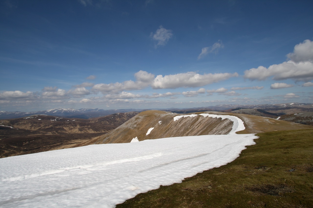
The longest self-propelled tour of the perfect week we spent in Braemar in spring 2008 led us to the Glen Ey Munros of An Socach, Beinn Iutharn Mhor and Carn Bhac. From the shop where we had rented the bikes Alex, Frank and me followed the road Linn of Dee road up to Inverey. There we left the tarmac road and cycled the track leading up Glen Ey. The track climbs beside the Ey Burn and debouches in the upper glen where two successive grassy flats make for easy progress. It finally ends at the ruins of Altnour Lodge which is set in a very scenic location among the Munros of upper Glen Ey. We left the bikes, crossed the Ey Burn and climbed the north ridge of An Socach.
Quite exhausted we reached the end of that very steep climb and proceeded on the fairly level ground to the summit of An Socach where we had a break by the cairn (shelter) in the sunshine. From An Socach we turned south and descended steeply to a wide col before climbing quite moderate slopes to the flat summit of Carn a’ Chlarsaich. The cool waters of Loch nan Eun beckoned and so we continued over the grassy terrain to the shores of this remote loch. Again we took a longish, refreshing time-out before climbing semi-steep slopes to the col between Beinn Iutharn Bheag and Mam nan Carn. At the col we turned west and soon stopped to refill our water bottles with melt water flowing from one of the snow fields of the last winter still lingering on the hillside. Then it was another steep pull up the stone studded grassy south ridge of Beinn Iutharn Mhor to the summit perched above tiny Lochan Uaine in the corrie formed by the very steep scree slopes and outcrops of rock on the north side of the hill. The path continued for a few hundred metres along the corrie rim and then it dropped down a very steep grass and scree slope into the northern corrie. We ran down snowfields and scree and soon reached the flatter terrain in the wide corrie floor. From there we struck a more or less direct line to a low point in the ridge of Carn Bhac about a kilometre west of the summit of this last Munro of the day.
On the way we crossed a wide field of peat hags and bog. Thank providence that it hadn’t rained for three days. Otherwise this 2 kilometre stretch of very, very Scottish soil would have certainly gotten the better of us. But we were lucky and finally reached the ridge above dry-shod. On we walked to the Munro’s summit, rested again for a few minutes, ate some muesli bars and started the descent towards the Alltan Odhar were we picked up a developing path leading back to Altnour Lodge. Once there we stuffed our walking gear back into our rucksacks, took a few more photographs and cycled back to Inverey enjoying ourselves immensely on this very swift ride down Glen Ey! What a fine end to this exhausting walk. Having reached the road we took our time and cycled back to lovely Braemar, some bottles of cold Coca Cola and our comfy cottage. A great day on remote hills, about 30 kilometres of cycling and 25 kilometres of walking. We slept very well that night!
Description An Socach is a flat-topped hill between upper Glen Ey and the Baddoch Burn. It has two summits of almost equal height separated by a broad level ridge 2 kilometres long. The hill rises steeply above Glen Ey and the view up this glen to its northern spur Creag an Fhuathais is very impressive. On its east side, An Socach is hidden from the A93 road at the Glenshee Ski Centre by Carn Aosda and The Cairnwell, but it is from that direction that the ascent is most easily made. Two routes from the A93 are possible. The shorter one starts from the Ski Centre, crossing the col between The Cairnwell and Carn Aosda and descending past Loch Vrotachan to the Baddoch Burn. Once across the burn, climb easily to the lowest point of the summit ridge of An Socach and go west along the broad stony crest to the top. A longer but more pleasant route, avoiding the eyesores of the Ski Centre, starts from the point further north on the A93 road where the Baddoch Burn joins the Clunie Water. Go up the track to Baddoch farm and continue along the path beside the burn for about 2 kilometres before climbing the north-east ridge of An Socach which leads to its East Top.