M225 |
945 m. |
3101 ft.
Translation: Red hill
Pronuncation: kaarn jerrack
Three in one go was the plan of the day. The weather not looking too good we anticipated another day of soaking from the sky above and the spongey terrain below. Parking the car close to Shepherds Bridge we saw rain coulds coming up Glen Banchor. We donned our full rain gear and walked along the track on the broad floor of Glen Banchor which is a beautiful and scenic spot instilling in me a feeling of remoteness that contrasts starkly to the busy village life of Kingussie only minutes away by car.
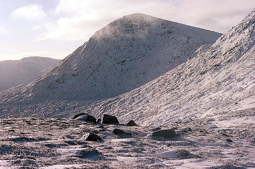
After one or two bends in the landrover track the house at Glenballoch came into view. A few metres before crossing the Allt Fionndrigh we turned right and used the landrover track leading up the glen beside the Allt. We quickly gained height at first and soon reached the more level terrain of the upper glen. From there the landrover track led us in a northwesterly direction. The glen narrowed considerably, the landrover track ended and a path led to a cut in the grassy hillside on the western side ot the glen. The path led through this cut and we very soon found ourselves on a beallach from which the whole extent of Glen Balloch could be seen – in driving rain. The terrain underfoot was 100% soaked sponge. Unfortunately my boots were not watertight anymore. Oh my, one more of those days! From the beallach we headed up Gleann Balloch skirting the western slopes of Meall na Ceardaich and aimed for the head of the glen. From there we climbed the final 300 metres due west through a break in the crags above and got to the summit of Carn Dearg, Munro No. 1. A short rest, some sleet, some cookies, some strong wind, gloves and on we went to Carn Ban.
The fence posts offered easy guides on the ensuing 8 kilometre high-level tramp over Carn Ban, Carn Ballach, Meall na Creughaich, Meall a’ Bhothain, point 908m and finally Carn Sgulain, Munro No.2. The plateau walk was ok since we had very spacious views, the rain having cleared away soon after Carn Ban. At the summit of Carn Sgulain we rested for some minutes and took in the views of the desolate moor stretching ahead to the north.
The final Munro of the day, A’ Chailleach, sang its siren song 😉 and we headed due south, crossed the deep trench of the Allt Cuil ea Caillich and climbed the remaining 150 metres to the summit of M251. Touching the third cairn we paused for a while, had a look around and descended the southern shoulder of the hill, turned east at an appropriate moment and reached the Allt a’ Chaorainn at the point where the path on its left side turns into a landrover track. A tent and a bicycle marked the spot. The footbridge close by was not needed since the Allt was easy to cross dryshod. We strolled down the last two kilometres to the parking enjoying the sunshine which had followed the clouds. At the car we took off our gear, enjoyed the views for a few moments and then drove back to Kingussie, a shower and a nice meal in the pub. This was a long day out on the moor. Much better than the books say. Although not one of my must-repeat-any-time-soon-hikes 🙂
Description This is the highest of the Monadhliath by a few metres. It is a long ridge running from south to north on the north side of Glen Banchor near its head. On its east side, Carn Dearg has a steep face 2 kilometres long above Gleann Ballach, and on its west side Loch Dubh lies in a deep corrie 1 kilometre south of the summit. The shortest approach to Carn Dearg starts at the end of the public road in Glen Banchor about 2 kilometres from Newtonmore. Continue up the glen by a track for 1 kilometre and follow the track north-west up the Allt Fionndrigh. From its end cross a col into Gleann Ballach and go almost to its head before climbing south-west to reach the ridge between Carn Dearg and its slightly lower north top, Carn Ban. A different route for the descent goes south along the ridge of Carn Dearg, over Carn Macoul and down its south-east ridge to return to Glen Banchor.