M272 |
919 m. |
3015 ft.
Translation: Roaring
Pronuncation: gaareech
When viewed from upper Glen Garry the Loch Quoich dam is quite an impressive, albeit ugly, concrete barrier plonked down onto the valley floor. But on the other hand it also provides easy access to the south shore of Loch Quoich, the creation of which it was instrumental in. So, we parked the car by the dam and walked over to the other side of the loch. As described in all the books we followed the boggy-ish path which in about 30 or 40 minutes delivered us at the foot of Gairich’s east ridge, Druim na Gaid Salaich. This we climbed, steeply at first, then on ground rising more gradually over Bac nam Foid to the spot where the path begins the final 300m climb to the summit ridge of Gairich. Before climbing up we took a short break, chatted with hikers coming down the hill and had a good look around.
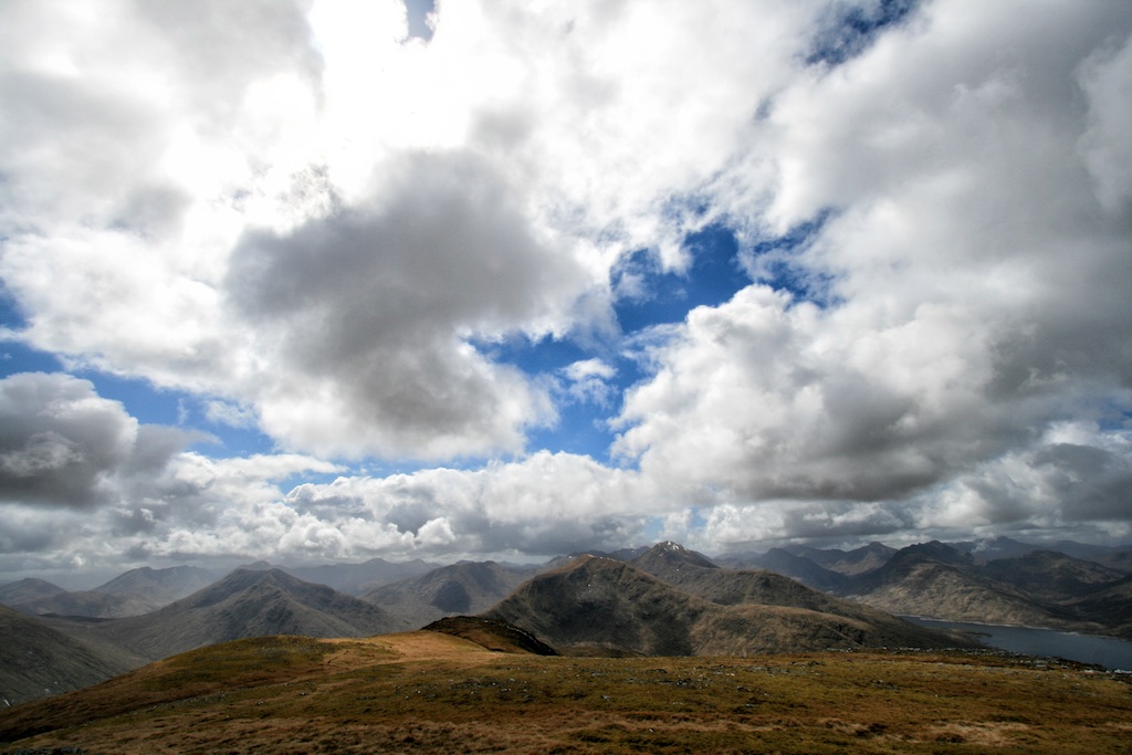
Since the weather had been acceptable bordering on good we expected to have some views of Knoydart from the summit but this is Scotland and you never know. Soon we shouldered our rucksacks and embarked on the final leg of the climb which was quite steep and surprisingly rocky in places. Very much different from the previous 6 or 7 km spent treading up the hill on easy ground. After some minor scrambling we finally reached the summit ridge and then the cairn. And would you believe it? The weather was good. Frank shot photographs and I spent the time at the summit enjoying the open 360 degree views of the landscape. Fine! But even though the weather was good there still was quite some wind on the bare summit. So we initiated the orderly retreat from the high parts of the hill and more or less retraced the exact steps to dam and car which we had taken on the ascent. After five hours we were back — just in time to escape the only heavy rain shower of the day! Great timing. All in all this was an easy hill offering great views from the summit. A good tour for a relaxed afternoon in the hills.
Description Gairich stands on the south side of Loch Quoich near the dam at its east end. There are no other hills close to it, so it is a conspicuous feature of the view up Glen Garry and dominates the east end of Loch Quoich. To its west a low col connects Gairich to Sgurr Mor 6 kilometres to the west. On its north side there are some steep corries above Loch Quoich and on the south side is the long lonely Glen Kingie. The ascent of Gairich is almost invariably made from the dam at the east end of Loch Quoich, any other approach, for example from the end of the public road at the west end of Loch Arkaig, being much longer. Cross the dam and go south for 2½ kilometres along a stalker's path which has a reputation for being extremely wet and boggy. At an intersection of paths go west and start the climb of the long east ridge of Gairich. When the path ends, continue along the broad crest which is fairly level for 2 kilometres to the final rise near the summit. The path reappears and leads up a rocky ridge. Do not follow a branch which goes left and leads nowhere, but climb fairly directly uphill by a steep path with some short rocky steps to the flat summit.