M248 |
932 m. |
3058 ft.
Translation: Yellow hill
Pronuncation: myowl boo-ee
A dreich day in Scotland was the weather forecast and a dreich day it turned out to be. But of course that did not keep us from ticking our Munros. The day can even boast a ‘first’ as regards the location of the lunch break.
Now, after having successfully reconnoitred the locations of all roads to all the dammed lochs in and around upper Glen Lyon on an earlier day, we made it to the Loch Daimh dam (Giorra dam) without a problem. We had intended to do the high-level tour of Loch Daimh and bag both Munros on the circuit. However, the prospect of close to 20km of ridge walking quickly lost its appeal when we donned our gear in driving rain and strong wind even at glen level. We chose to climb Stuchd an Lochain first. So we used the land rover track on the south shore of Loch an Daimh and as the books say picked up the path which leads to point 887m on the east ridge of Stuchd an Lochain. After the initial maybe 500 metres of easy going the path changed its character and turned into an unrelenting grind up the steep slopes of the mountain. The path surface is of a deplorable quality. It’s more like walking up a deep scar filled with scree, earth, loose rocks, bog and sand. Often a combination of all these within a few yards. Thank providence that it was not too sodden since the rain had been not so bad the day before. With considerable effort we reached the uppers parts of the hill and bumped into the one or two steps on the ridge which had to be surmounted before reaching point 887m. There a very strong wind greeted us.
From point 887m the obvious continuation along the ridge was the next point on the agenda. When the elements gave us some respite for a few seconds we looked down into the northern corrie way below us and caught a glimpse or two of Lochan nan Cat (why are so many lochans called by this funny name?). In about 25 to 30 minutes we reached the summit slopes of Stuchd an Lochain which we duly climbed to the top, touched the cairn and spent not one thought on descending via the interesting north ridge of the hill, since steep grass and exposure on a narrow ridge crest can become creepy in high winds and driving rain. We retraced our steps to the car. On this return leg of the hike the wind helped us a bit to get down the hill more quickly.
When we reached the Giorra dam we took our lunch break in the car. I think this was the first time that we ate sandwiches in the car in between ticking off two Munros on one day without moving the vehicle. On this day it was a welcome new variant, though!
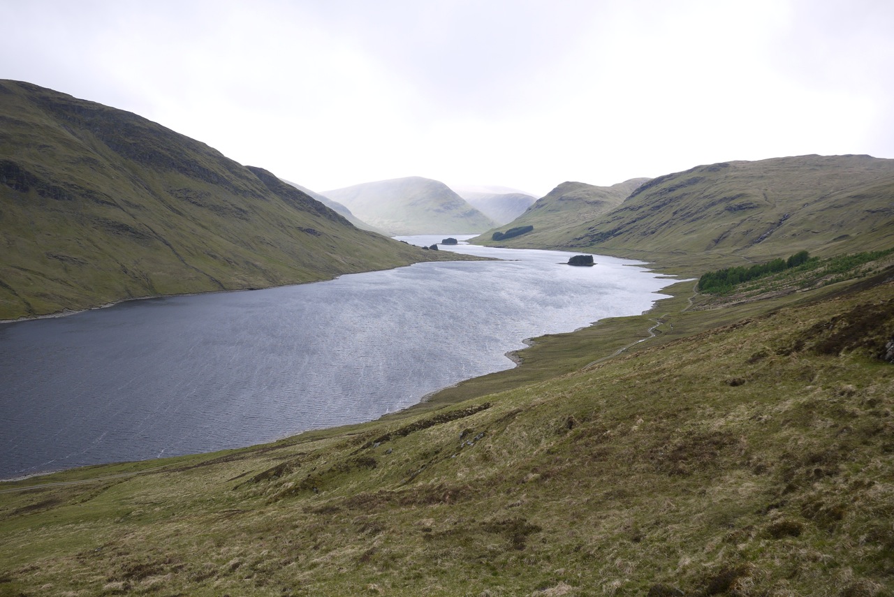
Then the second leg of the day called for our attention. We climbed to the land rover track which runs high above the north shore of Loch Daimh, picked up one of several paths heading up the hillside in a northerly direction and quickly gained height. The heather underfoot was quite squishy. Within an hour or so we had crossed the heathery and peaty terrain and gained the col between Meall a’ Phuill and the summit ridge/plateau of Meall Buidhe. Visibility was a bit iffy but the well-worn path left no doubt as to where we needed to go. Once on the very flat summit plateau it was another 15 minutes to the summit cairn of Meall Buidhe. Again as on Stuchd an Lochain there was zero visibility at the summit. So much for the best view point in the Southern Highlands. Yes you are right in assuming that we did not linger there for long :-). Here, too, we retraced our route of ascent but only to a certain point. Instead of walking down the squishy terrain of Corie Beithe we decided to return via the much drier and better defined ridge that forms the eastern boundary of Corre nam Miseach. The going was easy on stones and later on steep grass leading to the land rover track by the loch. This was a welcome change from the spongy terrain that had been the main fare on the Meall Buidhe’s menu. On the final kilometre back to the car Frank was even able to take a few nice photographs of Loch Daimh and the (foot of the) hills around it.
I would not call this my favourite day out in the Scottish Highlands but considering the dreich weather we had these two Munros proved to be the right choice. A pity we could not do the circular hike! The loch sure looks fine and its west end must be a remote place indeed! Maybe something for the second round of Munros?
Description Stuchd an Lochain is situated far up Glen Lyon, several kilometres west of Meggernie Castle. The finest feature of the mountain is the north face which drops steeply to Loch an Daimh, and the corrie high up on this face holds the little circular Lochan nan Cat. On the opposite of Loch an Daimh, Meall Buidhe is a rather undistinguished hill which is the highest point of an extensive area of rough moorland and flat-topped hills between Glen Lyon and Loch Rannoch. A public road climbs up from Glen Lyon to end below the dam at the east end of Loch an Daimh at a height of 430 metres, and this high starting point makes it quite possible to climb both hills in one day. Going to Stuchd an Lochain first, cross to the south end of the dam and climb up the grassy Coire Ban to reach the ridge above. Follow a line of fence posts west to Creag an Fheadain, then south-west to Sron Chona Choirein and finally west to Stuchd an Lochain.Starting out again from the north end of the dam, climb due north to Meall a' Phuill, an outlying top at the south corner of Meall Buidhe's east corrie. Continue round the edge of this corrie past some small cairns to a much larger cairn which marks the summit of Meall Buidhe.