M5 |
1258 m. |
4127 ft.
Translation: Peak of the little green loch
Pronuncation:
2011 This was supposed to be the “Kaisertour” of our extended Scotland 2011 weekend. It was kaiser but unfortunately the weather and clouds were not too kind to us. Since i had planned to go to Cairn Toul at least if not The Devil’s Point we started very early from the lower parking place. The mood was fine, the morning mist looked beautiful and the going was easy till we reached the Chalamain Gap. This is an impressive piece of rock gap which we mastered with some effort. Soon after the gap we lost height to cross Alt Druidh to start the ascent to the ridge.
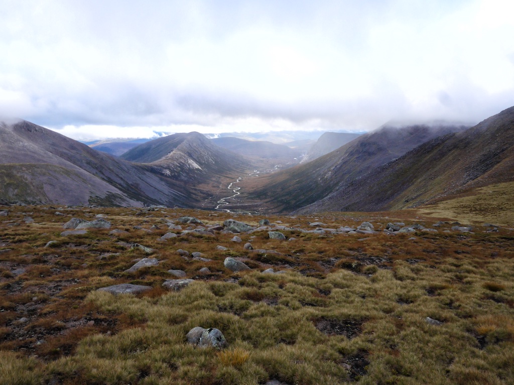
Unfortunately we were too soon engulfed in mist and this should not change for the rest of the day. Bugger. When we reached the ridge we had very little view and we used the southern edge for orientation and walking. So we reached the summit of Braeriach after 4,5h which we celebrated with an well earned rest. The conditions were not too inviting so the break was not the longest one and we started over again. Thomas and Markus called it a day and returned. I gave them my Landranger copy (to be regretted later). The rest of the party made quite a navigational effort to continue near the ridge and try to avoid to get lost in the western Cairngorms. We succeeded in reaching the summit of Sgòr an Lochain Uaine. After a short consideration i decided to give Cairn Toul a try while Cord, Joachim and Stefan returned. They used our other map while i trusted in my iPhone and the Anquet software installed (to be regretted later).
So i did a speed as/descent of Cairn Toul. Since i did not want to reascent The Angel’s Peak i tried to walk around but due to zero views and the fact that my iPhone died in the rain i was without any mapping support. I did my best not to walk too low and too much to the south but i did not succeed. Seeing myself already lost in the Grampians i decided to ascent again and search for the ridge which i reached after aprox. 20 minutes. Phew. From now on i did not left the ridge for more than an inch and i hurried to return to the guys. I visited Braeriach again and started the descent over the broad shoulder where i saw some walkers in the distance. I waved but they did not wave back so i hurried even more to reach them just to discover that these weren’t my guys but a different group which was remarkably slower than i.
And now the big hour of my headlamp came for the first time. The light of it was a welcome help even if the path after the gap was excellent. A sharp descent and a litte ascent over Allt Mor and i reached the parking place where the guys were waiting for me. 36 kilometres and 2200 metres of evelation. The longest munrobagging day i had the joy to endure. I threw my gear in the trunk and we headed for our lovely treehouse where Thomas and Markus had already stocked up our fridge provisions and cooked a lovely meal.
Description The west side of the Lairig Ghru in its southern half is dominated by Cairn Toul and its two satellites, Sgor an Lochain Uaine and The Devil's Point. This is probably the finest group of mountains in the Cairngorms, and unlike nearly all the others which tend to be plateau-topped, these three all have well-defined pointed summits. Cairn Toul and Sgor an Lochain Uaine share with Braeriach the grandeur of An Garbh Choire, and the narrow ridge of the Sgor which rises steeply from the little green loch to its summit is one of the finest features of the corrie. 4 kilometres to their south-east, The Devil's Point may be a much lower peak, but the continuous bastion of slabs round its south and east sides gives it the appearance of impregnability. Any route to these mountains is very long, whether it is from the south via Glen Lui or the River Dee, from the north via Gleann Einich (with the help of a bicycle) or from the west over the Moine Mhor from Glen Feshie. Of these possibilities, the traditional route is from the south, starting at the foot of Glen Lui and following the right of way via Derry Lodge and Glen Luibeg to reach the southern entrance to the Lairig Ghru opposite Corrour Bothy. Cross the River Dee and climb up Coire Odhar to the col at its head, from where it is a short climb to The Devil's Point. Then go north-west up a long smooth slope and along the edge of Coire an t-Saighdeir to reach Cairn Toul. Descend west and go along the edge of the corrie of the green lochan to reach Sgor an Lochain Uaine.