M192 |
963 m. |
3160 ft.
Translation: Hill of the kite or buzzard
Pronuncation: kaarn a klaavan
A “good afternoon walk” from Forest Lodge on a stalkers path is what Mr McNeish proposes in “The Munros – Scotland’s Highest Mountains” for this remote hill. Not without adding that alternatively one could walk in from Old Blair and “make a day of it”. Just how one is supposed to make it to Forest Lodge before one can enjoy the afternoon walk is left open but one can assume that Mr McNeish might opt for staying at the lodge, flying in by helicopter, hitch-hiking a ride on somebody’s Land Rover or using some other means of transport to get to the Lodge.
Frank and I rode on our bicycles and chose the less scenic ascent of the hill by means of the Land Rover track from Clachglas. The bicycle ride up beautiful Glen Tilt was fun and the perfect condition of the dirt road up the glen made things quite easy. We were not alone in Glen Tilt either: people on horses, the odd car and one or two further groups of hikers kept us company.
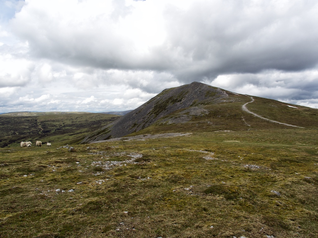
Before we reached Clachglas we left our bicycles beside a field in which three horses spent a seemingly relaxing day doing things that horses do. The Land Rover track up the south-west shoulder of Carn aíChlamain is green at first but becomes very rough and rocky once the first bend of the track is reached and the summit of Carn aíChlamain comes into view. Route finding was no problem since the vehicle track climbs all the way almost to the summit. We made good progress and then paused in the heather beside the track to drink some water and eat an apple.
Apart from a fresh wind that got stronger the higher up we climbed the day was of a benign character. The sun took turns with some clouds and only a very few drops of rain fell onto our t-shirts. Once above the 900m contour the wind chill became really strong so we needed to wear jumpers and wind-proofs. The by now faint track brought us directly to the summit pyramid of Carn a’Chlamain where the last 40 or 50m of the ascent were completed on a scree-covered path. The rocky summit with its biggish cairn is a good view point for Beinn a’Ghlo and the other three hills of the Circle of Tarf: Beinn Dearg (climbed two days later), Carn an Fhidhleir and An Sgarsoch (both climbed in 2013).
The wind-chill and the resulting cold made us leave the summit after maybe 15 minutes. The return to Glen Tilt was made by reversing the way of ascent. Soon the sun came out again and we could peel off one or even two layers of protection once we were below 800m. The home leg of the hike was rather uneventful apart from the sudden appearance of a Toyota Hilux which climbed the rather steep and rough sections of the track with apparent ease. Back in Glen Tilt a light rain shower caught up with us but soon subsided again. What followed was an easy and speedy ride back to Old Blair and our car.
The Carn a’Chlamain tour proved to be a nice bicycle ride combined with a straight-forward plod up and down a Land Rover track. Nothing to keep you awake at night re-living an epic day. Rather a piece of work necessary to tick another Munro on the list. Nonetheless I must admit that I enjoyed the day!
<br> <br>
Description Carn a' Chlamain is the highest point of an undulating plateau, intersected by some deep glens, on the north-west side of Glen Tilt about 11 kilometres north of Blair Atholl. It has a pointed summit with a big patch of grey screes on its south side, which makes the hill easily recognisable from viewpoints near Blair Atholl. This hill has the distinction of having once been climbed on horseback by Queen Victoria.The distance from Blair Atholl makes a bicycle very useful for the approach up the private road in Glen Tilt. Cycle as far as the bridge over the Allt Craoinidh and climb the broad easy-angled south ridge of Carn a' Chlamain, following either a vehicle track or a path through the heather. Alternatively, cycle a few kilometres further to Forest Lodge and climb the zigzag path up the steep hillside behind the lodge to reach the easier upper slopes.