Sgor Gaoith

Heading north from Kingussie we stopped over at the Cairngorms to bag one Munro on a half-day hike. From Feshie Bridge we drove up the road leading to the parking a kilometre off Achlean farm. The day was quite nice. Sun and clouds took turns. From the parking we walked the road to the farm. A few hundred metres before the farm the path branched off to the left and we began the long but not too steep climb.

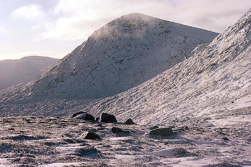
Once above the trees much of the ascent to Carn Ban Mor was clearly visible. Visible too was the fact that we were only two of dozens and dozens of hikers on the path. On we plodded overtaking a few walking parties and meeting two mountain bikers who rode down the path. This was quite appalling since the path was not at all suitable for bicycles in many places. Money spent on this very well-engineered path should not be put to waste by bicycles grinding up the path surface. At the short level section of the path before the final steep 250 metre climb the wind picked up considerably and we put on some more layers of clothes. Soon we reached the shoulder or col south of Carn Bàn Mor from where turned north, crossed the summit of this subsidiary top, reached the beallach at about 1020m below Sgorr Gaoith and climbed the final 90 metres to the summit of the Munro.

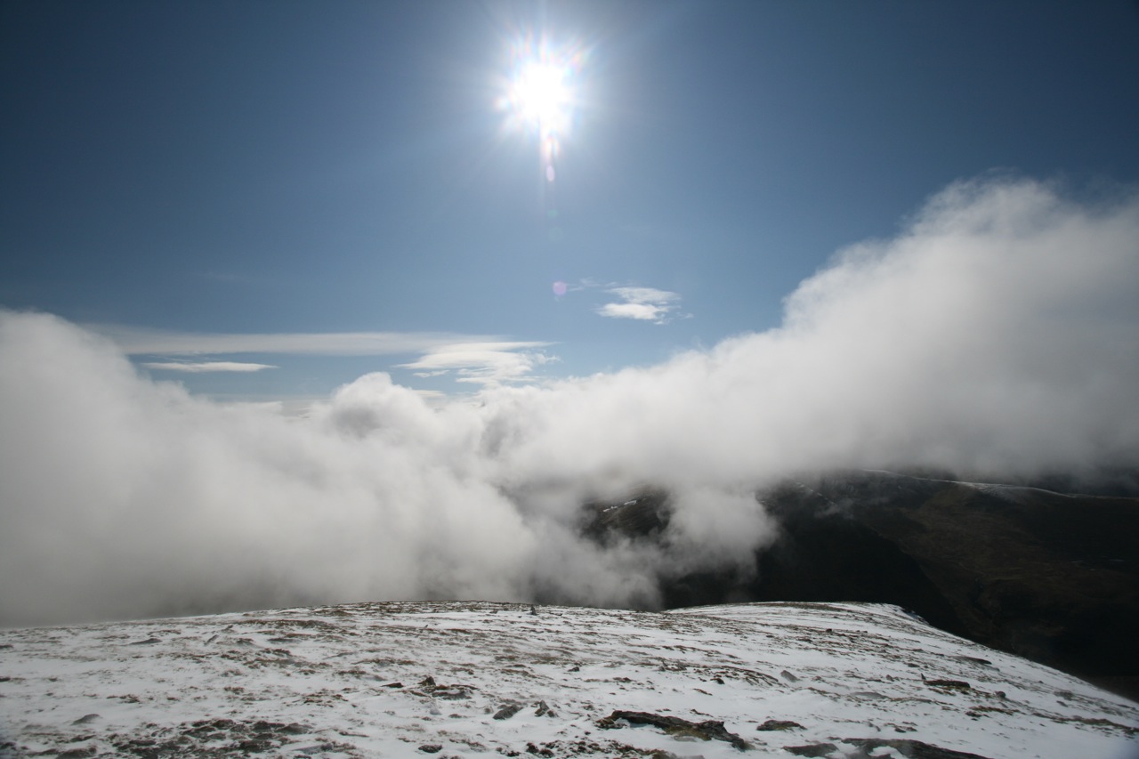
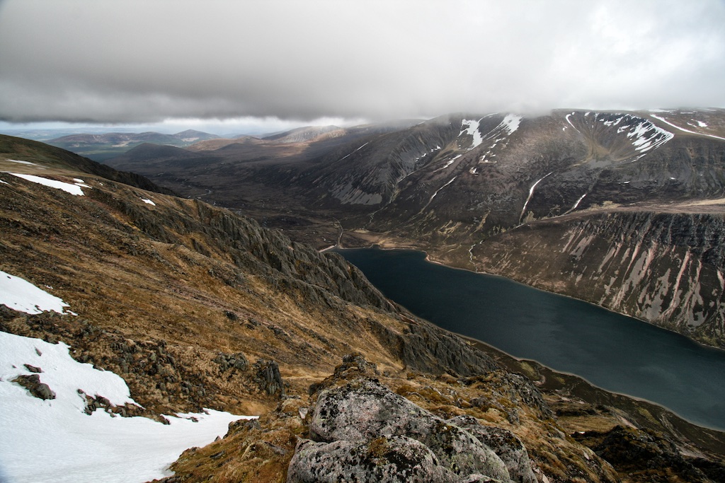
The wind was quite strong and we sought shelter to eat our sandwiches and have some tea. Directly east of the cairn a few ledges two metres below the summit offered a sheltered spot and perfect views of Loch Einich and the western slopes of Braeriach. Wonderful scenery, really wonderful! Soon after we left the cold summit of Sgorr Gaoith we were caught in a short snow shower- the only precipitation of the whole hike. On the way back we pondered bagging Mullach Clach a’ Bhlair, too, but decided we did not have the time to do that: Shopping for … [Read More]

2017-09-19T14:17:06+02:00May 2nd, 2009|2009, 2009 - 2000, The Cairngorms|

Carn Dearg

Three in one go was the plan of the day. The weather not looking too good we anticipated another day of soaking from the sky above and the spongey terrain below. Parking the car close to Shepherds Bridge we saw rain coulds coming up Glen Banchor. We donned our full rain gear and walked along the track on the broad floor of Glen Banchor which is a beautiful and scenic spot instilling in me a feeling of remoteness that contrasts starkly to the busy village life of Kingussie only minutes away by car.

After one or two bends in the landrover track the house at Glenballoch came into view. A few metres before crossing the Allt Fionndrigh we turned right and used the landrover track leading up the glen beside the Allt. We quickly gained height at first and soon reached the more level terrain of the upper glen. From there the landrover track led us in a northwesterly direction. The glen narrowed considerably, the landrover track ended and a path led to a cut in the grassy hillside on the western side ot the glen. The path led through this cut and we very soon found ourselves on a beallach from which the whole extent of Glen Balloch could be seen – in driving rain. The terrain underfoot was 100% soaked sponge. Unfortunately my boots were not watertight anymore. Oh my, one more of those days! From the beallach we headed up Gleann Balloch skirting the western slopes of Meall na Ceardaich and aimed for the head of the glen. From there we climbed the final 300 metres due west through a break in the crags above and got to the summit of Carn Dearg, Munro No. 1. A short rest, some sleet, some cookies, some strong wind, gloves and on we went to Carn Ban.

The fence posts offered easy guides on the ensuing 8 kilometre high-level tramp over Carn Ban, Carn Ballach, Meall na Creughaich, Meall a’ Bhothain, point 908m and finally Carn Sgulain, Munro No.2. The … [Read More]

2017-09-19T14:17:06+02:00May 1st, 2009|2009, 2009 - 2000, Glen Roy to the Monadhliath|

A’Chailleach

Three in one go was the plan of the day. The weather not looking too good we anticipated another day of soaking from the sky above and the spongey terrain below. Parking the car close to Shepherds Bridge we saw rain coulds coming up Glen Banchor. We donned our full rain gear and walked along the track on the broad floor of Glen Banchor which is a beautiful and scenic spot instilling in me a feeling of remoteness that contrasts starkly to the busy village life of Kingussie only minutes away by car.

After one or two bends in the landrover track the house at Glenballoch came into view. A few metres before crossing the Allt Fionndrigh we turned right and used the landrover track leading up the glen beside the Allt. We quickly gained height at first and soon reached the more level terrain of the upper glen. From there the landrover track led us in a northwesterly direction. The glen narrowed considerably, the landrover track ended and a path led to a cut in the grassy hillside on the western side ot the glen. The path led through this cut and we very soon found ourselves on a beallach from which the whole extent of Glen Balloch could be seen – in driving rain. The terrain underfoot was 100% soaked sponge. Unfortunately my boots were not watertight anymore. Oh my, one more of those days! From the beallach we headed up Gleann Balloch skirting the western slopes of Meall na Ceardaich and aimed for the head of the glen.

From there we climbed the final 300 metres due west through a break in the crags above and got to the summit of Carn Dearg, Munro No. 1. A short rest, some sleet, some cookies, some strong wind, gloves and on we went to Carn Ban. The fence posts offered easy guides on the ensuing 8 kilometre high-lveel tramp over Carn Ban, Carn Ballach, Meall na Creughaich, Meall a’ Bhothain, point 908m and finally Carn Sgulain, Munro No.2. The … [Read More]

2017-09-19T14:17:06+02:00May 1st, 2009|2009, 2009 - 2000, Glen Roy to the Monadhliath|

Carn Sgulain

Three in one go was the plan of the day. The weather not looking too good we anticipated another day of soaking from the sky above and the spongey terrain below. Parking the car close to Shepherds Bridge we saw rain coulds coming up Glen Banchor. We donned our full rain gear and walked along the track on the broad floor of Glen Banchor which is a beautiful and scenic spot instilling in me a feeling of remoteness that contrasts starkly to the busy village life of Kingussie only minutes away by car.

After one or two bends in the landrover track the house at Glenballoch came into view. A few metres before crossing the Allt Fionndrigh we turned right and used the landrover track leading up the glen beside the Allt. We quickly gained height at first and soon reached the more level terrain of the upper glen. From there the landrover track led us in a northwesterly direction. The glen narrowed considerably, the landrover track ended and a path led to a cut in the grassy hillside on the western side ot the glen. The path led through this cut and we very soon found ourselves on a beallach from which the whole extent of Glen Balloch could be seen – in driving rain. The terrain underfoot was 100% soaked sponge. Unfortunately my boots were not watertight anymore. Oh my, one more of those days!

From the beallach we headed up Gleann Balloch skirting the western slopes of Meall na Ceardaich and aimed for the head of the glen. From there we climbed the final 300 metres due west through a break in the crags above and got to the summit of Carn Dearg, Munro No. 1. A short rest, some sleet, some cookies, some strong wind, gloves and on we went to Carn Ban. The fence posts offered easy guides on the ensuing 8 kilometre high-level tramp over Carn Ban, Carn Ballach, Meall na Creughaich, Meall a’ Bhothain, point 908m and finally Carn Sgulain, Munro No.2. The … [Read More]

2019-08-18T09:32:47+02:00May 1st, 2009|2009, 2009 - 2000, Glen Roy to the Monadhliath|

Geal Charn

This hill being the first in the 2009 outing we were still quite stiff when it came to getting our act together: putting on the gear, stuffing the rucksack, lacing the boots and all. Finally we were ready, though, and set out from Garva Bridge to climb this solitary Munro.

We crossed the infant River Spey, followed the landrover track for a few hundred metres and then walked on the open turf in the general direction of Geal Charn’s southwest ridge. At the confluence of the Allt Coire nan Dearcag and Feith Talagain the grassy path started to become a little steeper and the first stones appeared. We tramped up the ridge and were soon engulfed by fog and clouds. Passing a few minor crags at about 600m located on the western side of the hill the path climbed the somewhat steeper middle section of the hill before leveling out close to the summit.

Visibility was restricted to maybe 20 metres when we reached the cairn. A short break, a sip of water, one Mars bar, rucksack back on and off we went. With no views to be had of the rest of the Monadhliath hills we skipped the idea of returning by way of Glen Markie and simply retraced our steps to the car. A good hill for a short afternoon hike. A pleasant way to start the holiday and one of the few hills in 2009 which did not put our waterproof gear to the test! 🙂

2018-08-30T09:03:51+02:00April 30th, 2009|2009, 2009 - 2000, Glen Roy to the Monadhliath|

Beinn Liath Mhor Fannaich

May 2009 was the wettest hiking season in Scotland that I ever had the privilege of experiencing. This tour proved to be no different from the average squishy, slithering, sleety, soaking standard. Having set our mind on ticking off the four eastern Munros of the Fannaichs we approached the hills from the parking on the A835 between Loch Droma and Loch Glascarnoch which is at the bridge over the Abhainn an Torrain Duibh.

On the left bank of the Abhainn we followed the bends of the burn which carried a lot (!) of water indeed. The going was good and the path was sort of dry. Soon we reached the confluence of the Allt an Loch Sgeirich and the Abhainn a’Ghiubhais Li, crossed the first and continued our tramp along the left bank of the latter. We did not (!) use the bridge but climbed further on the deteriorating path. Higher up the burn we managed to cross it and headed over heathery terrain up the gentle slopes of Meallan Bhuide. Well, close to the rounded summit of this hillock the rain caught us and ended the short intermezzo of two hours walking without water coming down (my feet were soaked anyway, so hey, what difference does it make?). Loch Gorm came into view. It nestled nicely between the crags of Meall Gorm and the corrie headwall which lay ahead.

We climbed into the hanging corrie above the loch, veered in a south easterly direction and came to the summit slopes of An Coileachan. At the summit sleet was coming down so the short rest was rather uncomfortable. From this first Munro we turned north-west, crossed the area at the head of the corrie of ascent and climbed the grassy slopes, interspersed with rocks, which lead to the very flat ridge of Meall Gorm. The wind now caught us, things became considerably colder and the visibility dropped to 50 meters.

At a stone shelter shortly before the summit we added an additional layer of warmer fleece in driving … [Read More]

2019-10-19T14:39:04+02:00September 1st, 2002|2002, 2009, 2009 - 2000, Loch Marree to Loch Broom|

Sgurr Mor

2009 May 2009 was the wettest hiking season in Scotland that I ever had the privilege of experiencing. This tour proved to be no different from the average squishy, slithering, sleety, soaking standard. Having set our mind on ticking off the four eastern Munros of the Fannaichs we approached the hills from the parking on the A835 between Loch Droma and Loch Glascarnoch which is at the bridge over the Abhainn an Torrain Duibh.

On the left bank of the Abhainn we followed the bends of the burn which carried a lot (!) of water indeed. The going was good and the path was sort of dry. Soon we reached the confluence of the Allt an Loch Sgeirich and the Abhainn a’Ghiubhais Li, crossed the first and continued our tramp along the left bank of the latter. We did not (!) use the bridge but climbed further on the deteriorating path. Higher up the burn we managed to cross it and headed over heathery terrain up the gentle slopes of Meallan Bhuide. Well, close to the rounded summit of this hillock the rain caught us and ended the short intermezzo of two hours walking without water coming down (my feet were soaked anyway, so hey, what difference does it make?). Loch Gorm came into view. It nestled nicely between the crags of Meall Gorm and the corrie headwall which lay ahead.

We climbed into the hanging corrie above the loch, veered in a south easterly direction and came to the summit slopes of An Coileachan. At the summit sleet was coming down so the short rest was rather uncomfortable. From this first Munro we turned north-west, crossed the area at the head of the corrie of ascent and climbed the grassy slopes, interspersed with rocks, which lead to the very flat ridge of Meall Gorm. The wind now caught us, things became considerably colder and the visibility dropped to 50 meters. At a stone shelter shortly before the summit we added an additional layer of warmer fleece … [Read More]

2017-09-19T14:18:52+02:00September 1st, 2002|2002, 2009, 2009 - 2000, Loch Marree to Loch Broom|
Go to Top