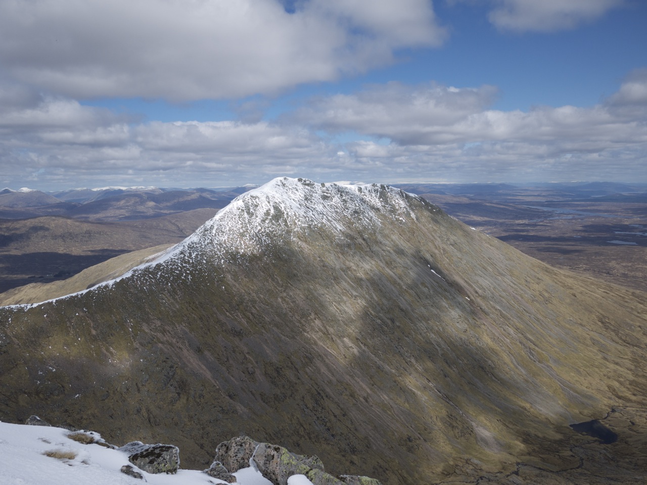
Meall a’Bhuiridh

The White Corries is the name given to the ski area on the north-west slopes of Meall a’Bhuiridh. I had climbed this hill and its stately neighbour Creise in September 1998 in the company of Stephanie and Birgit. That was an easy day: We did the tour up and down the ski slopes and to and fro the nice sharp connecting ridge and col between the two Munros.

This time round Frank and I had opted for something slightly more challenging: A circuit route of the two Munros. No matter what choice of route you take, the hike invariably starts at the car park of the White Corries ski centre. On the day we visited these hills there was a down-hill MTB-race going on. Gee, some of these down-hill racing guys are real techies.

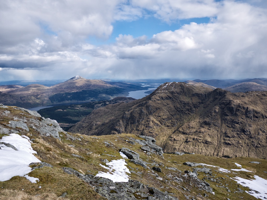
We did not linger long. As planned we set out across the moor in a westerly direction below the crags of Creag Dubh. The going was ok. There were traces of several parallel paths on this grassy, heathery and boggy section. Then after half an hour or so we rounded the corner and reached the Cam Ghleann. There a path leads down to the Allt Cam Ghlinne and sticks to the left bank of this burn. The surroundings are really impressive with the craggy ridges and slopes of Creise/Sron a’ Ghlais Choire and the beautiful Allt in the glen which sports several waterfalls. The good weather also helped in raising our expectations.

Well, our expectations were high since we wanted to climb the steep north-east ridge of Creise’s subsidiary top Stob a’ Ghlais Choire. Looking at the ridge from the glen it looks rather foreboding but we just believed the books, crossed the Allt Cam Ghlinne and started the ever steepening climb first over grass, then, after a first line of crags had been outflanked, directly on rocks. This was great fun. After some time of sustained scrambling the terrain became less steep and the more open slopes interspersed with some rocks and crags made for easier progress. … [Read More]

2017-09-19T14:16:15+02:00April 28th, 2012|1998, 2012, 2019 - 2010, Strath Orchy to Loch Leven|

Ben Vane

On 27 April 2012 Frank and I had touched down in Edinburgh on time, picked up our car at the Hertz rental counter and then set out on the drive to our first Munro of 2012: Ben Vane. We reached the public parking opposite the Inveruglas power station in the early afternoon. There we packed our rucksacks for the 14 km trip up Ben Vane. The weather was good, no rain in sight, clouds and sunshine. We walked along the A82 until we reached the road beside the Inveruglas Water.

The walk is quite scenic and after a few hundred metres of climbing the road soon levels out in Coiregrogain, a fine basin with A’Chrois and Ben Vane at its western end. At a prominent bridge over the Inveruglas Water we took a left turn and continued up a Landrover track for about 500 metres. Then, at a cairn, we left the track and embarked on the climb of Ben Vane’s steep east ridge. First on grass and then through outcrops and over bands of rocks we treaded up the increasingly steep ridge. Views became more open as height was gained.

After three quarters of the climb my stomach sent clear signs that I had eaten way to little that day. Thus my legs got wobbly due to the fast-dropping sugar level in my blood. Alas, soon we reached the summit, touched the cairn and Frank was so good to give me two of his muesli bars for sustenance. The pause at the summit was nice. It was a quiet afternoon and there was hardly any wind blowing during our 15 minutes at the summit.

Then, with the beautiful hill bagged, we retraced our steps down the east ridge back to Coiregrogain, the Inveruglas Water and the tarmac road leading back to the A82 where our faithful car was waiting for us. The gear was dumped in the car’s boot and gulps of water were guzzled from a bottle left behind barely four hours earlier. Then it was a short drive to Crianlarich, … [Read More]

2017-09-19T14:16:15+02:00April 27th, 2012|2012, 2019 - 2010, Loch Lomond to Loch Tay|
Go to Top