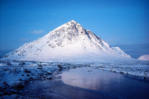
Stob Dubh

On the fourth day of our Scotland 2012 session and after some really great hikes like Creise and The Mamores Cord took his day off so i had the chance to bag Buachaille Etive Beag which he already had bagged some years ago. And it should be the only bad weather day of the complete 2012 session.

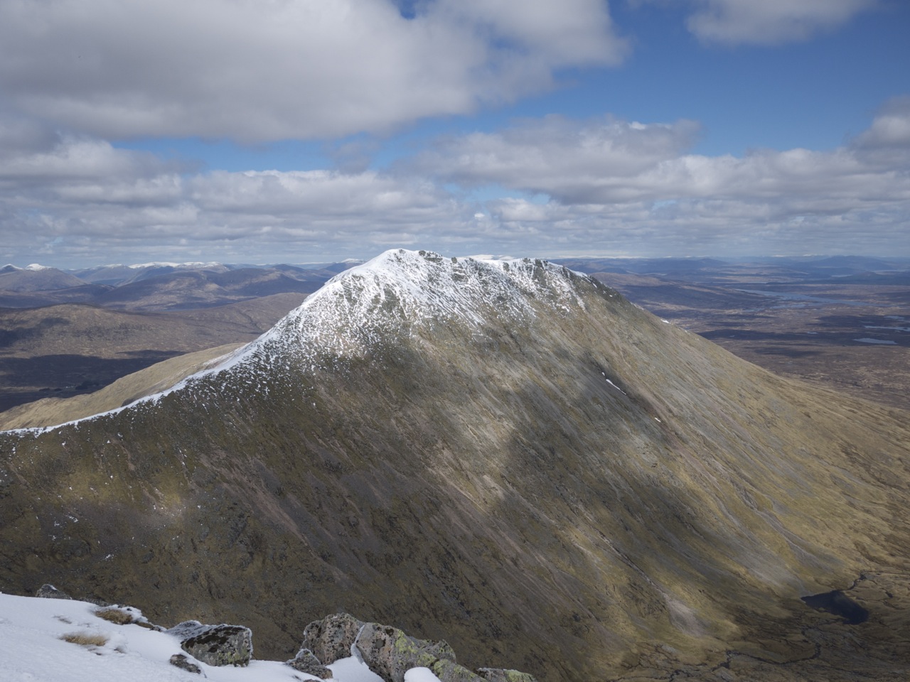
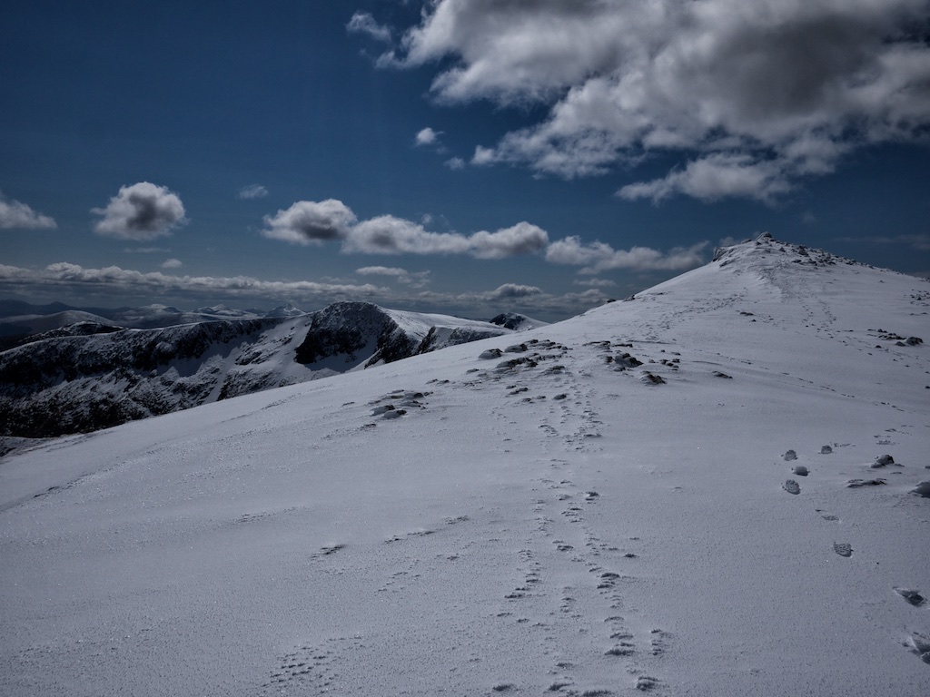
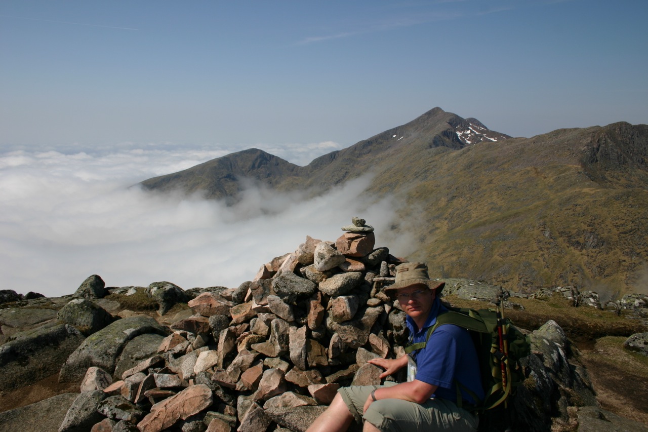
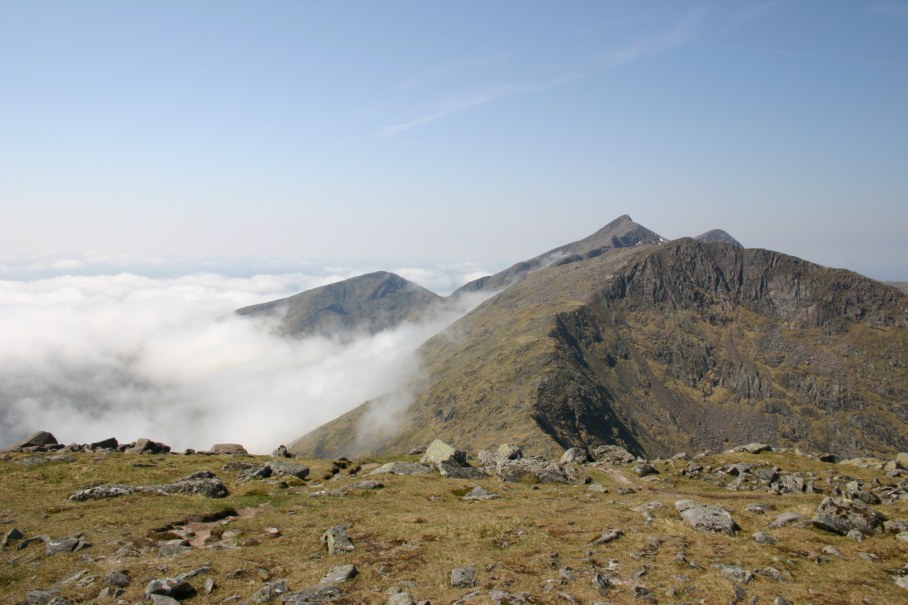
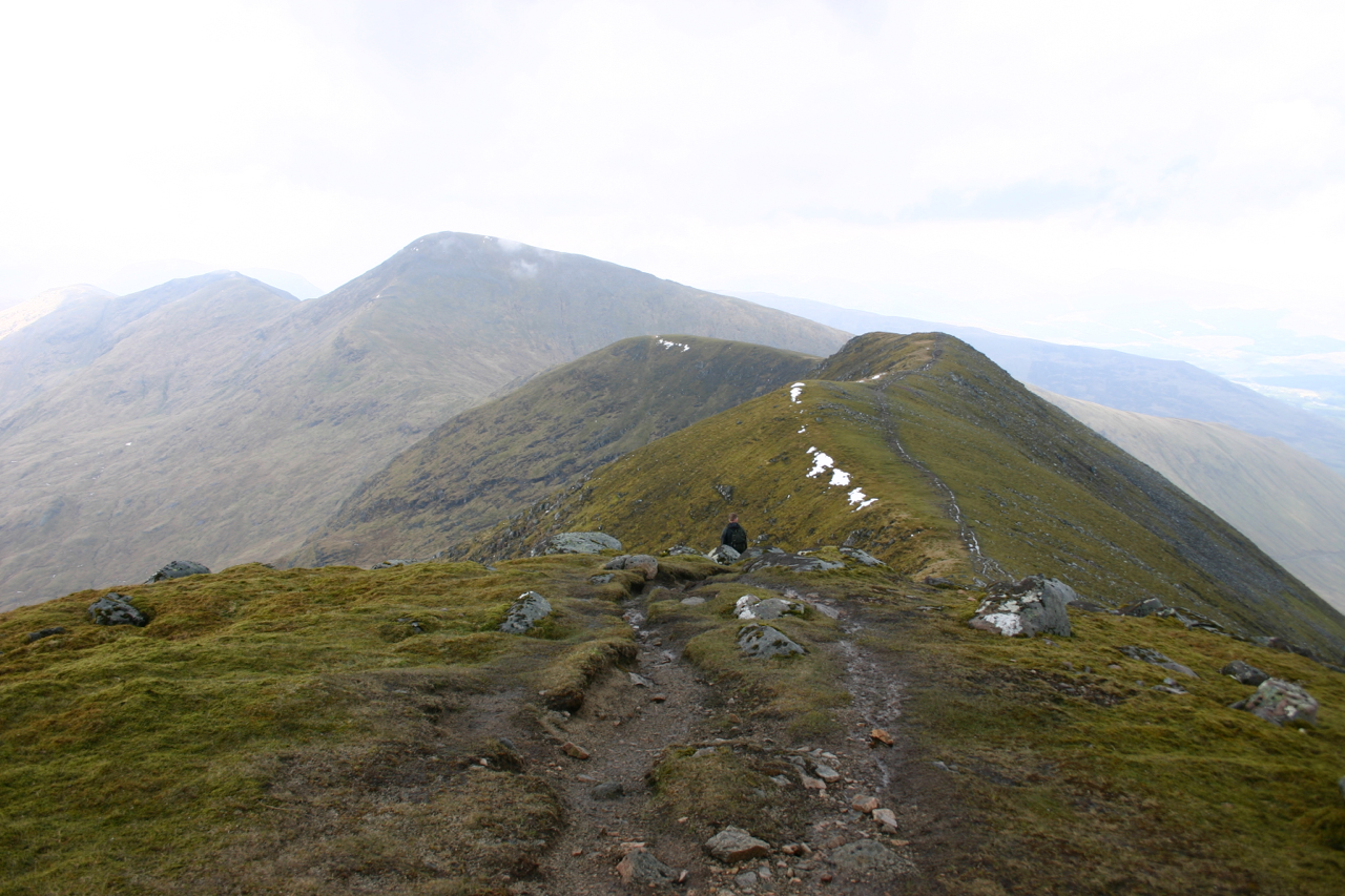
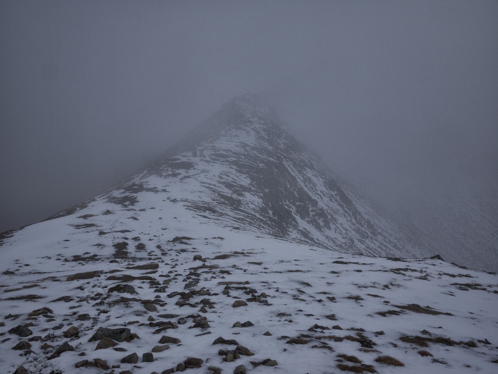
Cord drove me to the parking place at the A82 and we negotiated that he should be here 3 hours later again (a little too optimistic). I walked the very good path to the start of the ascent where the modest climbing began. After 30 minutes i reached the bealach which lay just below the clouds and i had some very interesting views of the Bidean ridges which were already covered in clouds. So i headed of to the first Munro of the day Stob Coire Raineach which i reached in no time and with no views which was a pity since it is such a good view point for Glen Coe. I took the mandatory summit picture and returned to the bealach to start the ascent to the next Munro Stob Dubh. This should be a more interesting and longer walking but you sense it: no views at all. At the ascent i met the only group of walkers – they walked with crampons! – of the day. After a little mountain gossip we all headed our way. Since it was cold, wet and windy i just touched the cairn and returned.

From the bealach it was an easy descent and since i was slightly overdue i sped up the last mile and reached the parking place where Cord was waiting – reading a newspaper in the car. All in all it was a good day and i bagged my last – real – Glen Coe Munros.


2017-09-19T14:16:14+02:00April 30th, 2012|1998, 2012, 2019 - 2010, Strath Orchy to Loch Leven|

Meall a’Bhuiridh

The White Corries is the name given to the ski area on the north-west slopes of Meall a’Bhuiridh. I had climbed this hill and its stately neighbour Creise in September 1998 in the company of Stephanie and Birgit. That was an easy day: We did the tour up and down the ski slopes and to and fro the nice sharp connecting ridge and col between the two Munros.

This time round Frank and I had opted for something slightly more challenging: A circuit route of the two Munros. No matter what choice of route you take, the hike invariably starts at the car park of the White Corries ski centre. On the day we visited these hills there was a down-hill MTB-race going on. Gee, some of these down-hill racing guys are real techies.

We did not linger long. As planned we set out across the moor in a westerly direction below the crags of Creag Dubh. The going was ok. There were traces of several parallel paths on this grassy, heathery and boggy section. Then after half an hour or so we rounded the corner and reached the Cam Ghleann. There a path leads down to the Allt Cam Ghlinne and sticks to the left bank of this burn. The surroundings are really impressive with the craggy ridges and slopes of Creise/Sron a’ Ghlais Choire and the beautiful Allt in the glen which sports several waterfalls. The good weather also helped in raising our expectations.

Well, our expectations were high since we wanted to climb the steep north-east ridge of Creise’s subsidiary top Stob a’ Ghlais Choire. Looking at the ridge from the glen it looks rather foreboding but we just believed the books, crossed the Allt Cam Ghlinne and started the ever steepening climb first over grass, then, after a first line of crags had been outflanked, directly on rocks. This was great fun. After some time of sustained scrambling the terrain became less steep and the more open slopes interspersed with some rocks and crags made for easier progress. … [Read More]

2017-09-19T14:16:15+02:00April 28th, 2012|1998, 2012, 2019 - 2010, Strath Orchy to Loch Leven|

Creise

The White Corries is the name given to the ski area on the north-west slopes of Meall a’Bhuiridh. I had climbed this hill and its stately neighbour Creise in September 1998 in the company of Stephanie and Birgit. That was an easy day: We did the tour up and down the ski slopes and to and fro the nice sharp connecting ridge and col between the two Munros.

This time round Frank and I had opted for something slightly more challenging: A circuit route of the two Munros. No matter what choice of route you take, the hike invariably starts at the car park of the White Corries ski centre. On the day we visited these hills there was a down-hill MTB-race going on. Gee, some of these down-hill racing guys are real techies.

We did not linger long. As planned we set out across the moor in a westerly direction below the crags of Creag Dubh. The going was ok. There were traces of several parallel paths on this grassy, heathery and boggy section. Then after half an hour or so we rounded the corner and reached the Cam Ghleann. There a path leads down to the Allt Cam Ghlinne and sticks to the left bank of this burn. The surroundings are really impressive with the craggy ridges and slopes of Creise/Sron a’ Ghlais Choire and the beautiful Allt in the glen which sports several waterfalls. The good weather also helped in raising our expectations.

Well, our expectations were high since we wanted to climb the steep north-east ridge of Creise’s subsidiary top Stob a’ Ghlais Choire. Looking at the ridge from the glen it looks rather foreboding but we just believed the books, crossed the Allt Cam Ghlinne and started the ever steepening climb first over grass, then, after a first line of crags had been outflanked, directly on rocks. This was great fun. After some time of sustained scrambling the terrain became less steep and the more open slopes interspersed with some rocks and crags made for easier progress. … [Read More]

2017-09-19T14:16:15+02:00April 28th, 2012|1998, 2012, 2019 - 2010, Strath Orchy to Loch Leven|

Stob Dearg

For many years Joachim, Markus, Stefan, Thomas and I have been spending a long weekend together once a year for hiking. After having been rather “flat” so far, we chose Scotland for 2008. For quite some time I wanted to introduce the boys to the beauty of the Highlands and above all to my passion for the Munros. But it was also clear to me that, in contrast to the previous hikes, I should and had to explicitly point out seriousness, weather conditions and conditional conditions. Which, of course, should prove to be the case. And since we still had a bed available and in my opinion Cord would also fit well with the boys, we granted him asylum for the 4 days in Scotland.

After we had flown from Cologne to Edinburgh at the lecture, Cord arrived in Cologne coming from Berlin, followed first the trip to Kinlochleven. In Callander we bought food and drinks and then drove through Rannoch Mor with obligatory photo break. The weather was fresh but pleasant. As we approached Glen Coe, majestically guarded by the big shepherd, my hint “we’ll go up there tomorrow” caused a rather disbelieving shake of the head. In the Glen Coe itself we took another photo break. After that we went straight to Kinlochleven to move to the beautifully situated Garbh Bhein Cottage, which offers great views of the Mamores. Beer, fire and dinner were the successful conclusion to the arrival day.

The next morning it showed up that my reference to the Scottish weather conditions and the insistent requests to take rainproof clothes had not been in vain. It was raining heavily, visibility was severely restricted and motivation had dropped considerably. Here it showed up that it is of advantage to have motivation artists and rainignoranten thereby. At 10 o’clock we stood – still a bit insecure, but at least fully dressed and equipped – on the parking lot near Altnafeadh and started, defying the rain!

The steep ascent through the Coire na Tulaich took up all our concentration, as we … [Read More]

2022-01-17T07:34:22+01:00October 15th, 2008|2008, 2009 - 2000, Strath Orchy to Loch Leven|

Stob Diamh

Stob Diamh and Ben Cruachan were the hills of 11 May 2004. The BBC weatherforecast had predicted some morning clouds and clear skies for the second part of the day. So, we parked our car in the lay-by close to the railway station below the Falls of Cruachan in morning mist. The effect of the Ring of Steall done the day before were still giving my muscles a hard time. On the path that leads up the eastern bank of the burn we climbed steeply through trees close to the gorge of the Falls. This path is steep indeed and not to be recommended as an easy start for the day.

After about 300m the path levelled off, left the wooded area and then the Cruachan Dam came into view. We reached the Cruachan Dam access road and walked on the tarmac to the dam where we followed the path along the eastern side of the reservoir. We soon reached the spot where the path branches off to the east and up the hillside. At around 500m the clouds engulfed us. Soon afterwards we stopped for a snack close  to some rocks. Then, up the path we went, heading as good as we possibly could in the fog and clouds for the ridge leading up to Stob Garbh.

At about 800m the cloud cover started shifting and we had some glimpses of the peaks – Beinn a’Bhùiridh being the first, then the ridge to Stob Garbh and finally Ben Cruachan to the west. Soon afterwards we cleared the clouds for good and walked up to Stob Garbh and then to Stob Diamh above a sea of white clouds. Marvellous, it almost looked like a temperature inversion in winter. At the summit of Stob Diamh Frank and I ate half of our sandwiches and enjoyed the prospect of a long ridge-walk in the sunshine.

Enthusiasm soon drove us on over Drochaid Ghlas and some interesting views of Coire Caorach opened up at the top of this intermediate top. In due time we reached the … [Read More]

2017-09-19T14:17:55+02:00May 11th, 2004|2004, 2009 - 2000, Strath Orchy to Loch Leven|

Ben Cruachan

Stob Diamh and Ben Cruachan were the hills of 11 May 2004. The BBC weatherforecast had predicted some morning clouds and clear skies for the second part of the day. So, we parked our car in the lay-by close to the railway station below the Falls of Cruachan in morning mist. The effect of the Ring of Steall done the day before were still giving my muscles a hard time. On the path that leads up the eastern bank of the burn we climbed steeply through trees close to the gorge of the Falls. This path is steep indeed and not to be recommended as an easy start for the day.

After about 300m the path levelled off, left the wooded area and then the Cruachan Dam came into view. We reached the Cruachan Dam access road and walked on the tarmac to the dam where we followed the path along the eastern side of the reservoir. We soon reached the spot where the path branches off to the east and up the hillside. At around 500m the clouds engulfed us. Soon afterwards we stopped for a snack close  to some rocks. Then, up the path we went, heading as good as we possibly could in the fog and clouds for the ridge leading up to Stob Garbh.

At about 800m the cloud cover started shifting and we had some glimpses of the peaks – Beinn a’Bhùiridh being the first, then the ridge to Stob Garbh and finally Ben Cruachan to the west. Soon afterwards we cleared the clouds for good and walked up to Stob Garbh and then to Stob Diamh above a sea of white clouds. Marvellous, it almost looked like a temperature inversion in winter. At the summit of Stob Diamh Frank and I ate half of our sandwiches and enjoyed the prospect of a long ridge-walk in the sunshine.

Enthusiasm soon drove us on over Drochaid Ghlas and some interesting views of Coire Caorach opened up at the top of this intermediate top. In due time we reached the … [Read More]

2017-09-19T14:17:55+02:00May 11th, 2004|2004, 2009 - 2000, Strath Orchy to Loch Leven|

Beinn Eunaich

The Munros closest to Stronmilchan are Beinn a’Chochuill and Beinn Eunaich. After a very good first night’s rest in our cottage on the right bank of the River Orchy we threw our stuff into the boot of the car and drove off to Castles farm where we parked just west of the bridge over the Allt Mhoille. We went back to the bridge, crossed it and took the landrover track leading to Castles Farm. The Angry Corrie had carried reports of rather unfriendly attitudes towards walkers which this estate had apparently shown during the FMD crisis of 2001 and afterwards. So, it was with some apprehension that we approached the farm buildings. And: Soon we saw a massive bull only 50 metres away from us outside the fenced grazing ground. Oh dear! We looked for good emergency escape routes should the bull prove to be aggressive but fortunately the animal took no interest in us and we proceeded as planned. Twohundred metres before the farm the track forks and we took the left-hand branch which steadily climbs up the hillside. Here we met a Landrover whose driver greeted us cordially. No sign of bad feelings here.

After about 200m we had to rest to drink some water and to take photographs of the Dalmally Horseshoe on the other side of the glen. After another ten minutes we passed the cairn marking the spot where the descent path from Stob Maol meets the landrover track. We continued, soon crossed the Allt Lairig Ianachain and went on to the next fork in the track where we took a right turn. After another 300 metres we left the track and started climbing the grassy and bouldery south-east ridge of Beinn a’Chochuill. This section of the climb proved to be quite steep but also manageable due to the benevolent character of the terrain. After doing zigzags for about 200m we found the path up the ridge. Enjoying the developing views of Ben Cruachan we quickly gained height on this rather uniformly steep slope. Then, … [Read More]

2017-09-19T14:17:55+02:00May 9th, 2004|2004, 2009 - 2000, Strath Orchy to Loch Leven|

Beinn a’Chochuill

The Munros closest to Stronmilchan are Beinn a’Chochuill and Beinn Eunaich. After a very good first night’s rest in our cottage on the right bank of the River Orchy we threw our stuff into the boot of the car and drove off to Castles farm where we parked just west of the bridge over the Allt Mhoille. We went back to the bridge, crossed it and took the landrover track leading to Castles Farm.

The Angry Corrie had carried reports of rather unfriendly attitudes towards walkers which this estate had apparently shown during the FMD crisis of 2001 and afterwards. So, it was with some apprehension that we approached the farm buildings. And: Soon we saw a massive bull only 50 metres away from us outside the fenced grazing ground. Oh dear! We looked for good emergency escape routes should the bull prove to be aggressive but fortunately the animal took no interest in us and we proceeded as planned. Two hundred metres before the farm the track forks and we took the left-hand branch which steadily climbs up the hillside. Here we met a Landrover whose driver greeted us cordially. No sign of bad feelings here.

After about 200m we had to rest to drink some water and to take photographs of the Dalmally Horseshoe on the other side of the glen. After another ten minutes we passed the cairn marking the spot where the descent path from Stob Maol meets the landrover track. We continued, soon crossed the Allt Lairig Ianachain and went on to the next fork in the track where we took a right turn. After another 300 metres we left the track and started climbing the grassy and bouldery south-east ridge of Beinn a’Chochuill. This section of the climb proved to be quite steep but also manageable due to the benevolent character of the terrain. After doing zigzags for about 200m we found the path up the ridge. Enjoying the developing views of Ben Cruachan we quickly gained height on this rather uniformly steep … [Read More]

2017-09-19T14:17:55+02:00May 9th, 2004|2004, 2009 - 2000, Strath Orchy to Loch Leven|

Stob Ghabhar

The second day of the spring outing in 2004 saw Frank and me parking our car near Victoria Bridge close to the west end of Loch Tulla. There were quite a few cars there already at 10 o’clock – but we did not meet many walkers on the hills later in the day. We packed our rucksacks, changed into our walking clothes and started the days work. On the land-rover track by the Abhainn Shira we strolled to the green hut where the path beside the Allt Toaig heads up north into Coire Toaig. We followed this path until it crossed the burn coming down from between Stob a’Choire Odhair and Beinn Toaig. From there we climbed up the zig-zags of the path leading to the upper slopes of Stob a’Choire Odhair.

Higher up the slope eased and we reached the summit of the first Munro of this day in due time. Good views of Rannoch Moor and the marvellous eastern corrie of Stob Ghabhar. After a good snack we continued down the west ridge of Stob a’Coire Odhar to the col at the head of Coire Toaig. Here Frank and I decided not to climb Stob Ghabhar by Sron nan Giubhas but by the steep north ridge of Aonach Eagach. From the foot of the ridge we marvelled at beautiful Corein Lochain, the cliffs and the lochan in the sunshine. The rocky side ridge proved to be quite interesting and entertaining but this sort of fun soon ended when we reached Aonach Eagach which, contrary to its evocative name, forms a perfectly straightforward and easy traverse to Stob Ghabhar.

The path from Aonach Eagach to the summit of the second Munro is obvious and before the final 100m rise of the ridge we noticed the cairn marking the start of the descent route. At the summit of Stob Ghabhar there was some shifting cloud cover which broke from time to time and allowed us to have tantalizing views of Coirein Lochain down below. Sitting at the cairn we were joined by … [Read More]

2017-09-19T14:17:56+02:00May 8th, 2004|2004, 2009 - 2000, Strath Orchy to Loch Leven|

Stob a’Choire Odhair

The second day of the spring outing in 2004 saw Frank and me parking our car near Victoria Bridge close to the west end of Loch Tulla. There were quite a few cars there already at 10 o’clock – but we did not meet many walkers on the hills later in the day. We packed our rucksacks, changed into our walking clothes and started the days work. On the land-rover track by the Abhainn Shira we strolled to the green hut where the path beside the Allt Toaig heads up north into Coire Toaig. We followed this path until it crossed the burn coming down from between Stob a’Choire Odhair and Beinn Toaig. From there we climbed up the zig-zags of the path leading to the upper slopes of Stob a’Choire Odhair.

Higher up the slope eased and we reached the summit of the first Munro of this day in due time. Good views of Rannoch Moor and the marvellous eastern corrie of Stob Ghabhar. After a good snack we continued down the west ridge of Stob a’Coire Odhar to the col at the head of Coire Toaig. Here Frank and I decided not to climb Stob Ghabhar by Sron nan Giubhas but by the steep north ridge of Aonach Eagach. From the foot of the ridge we marvelled at beautiful Corein Lochain, the cliffs and the lochan in the sunshine. The rocky side ridge proved to be quite interesting and entertaining but this sort of fun soon ended when we reached Aonach Eagach which, contrary to its evocative name, forms a perfectly straightforward and easy traverse to Stob Ghabhar.

The path from Aonach Eagach to the summit of the second Munro is obvious and before the final 100m rise of the ridge we noticed the cairn marking the start of the descent route. At the summit of Stob Ghabhar there was some shifting cloud cover which broke from time to time and allowed us to have tantalizing views of Coirein Lochain down below. Sitting at the cairn we were joined by … [Read More]

2017-09-19T14:17:56+02:00May 8th, 2004|2004, 2009 - 2000, Strath Orchy to Loch Leven|
Go to Top