Beinn Mheadhoin

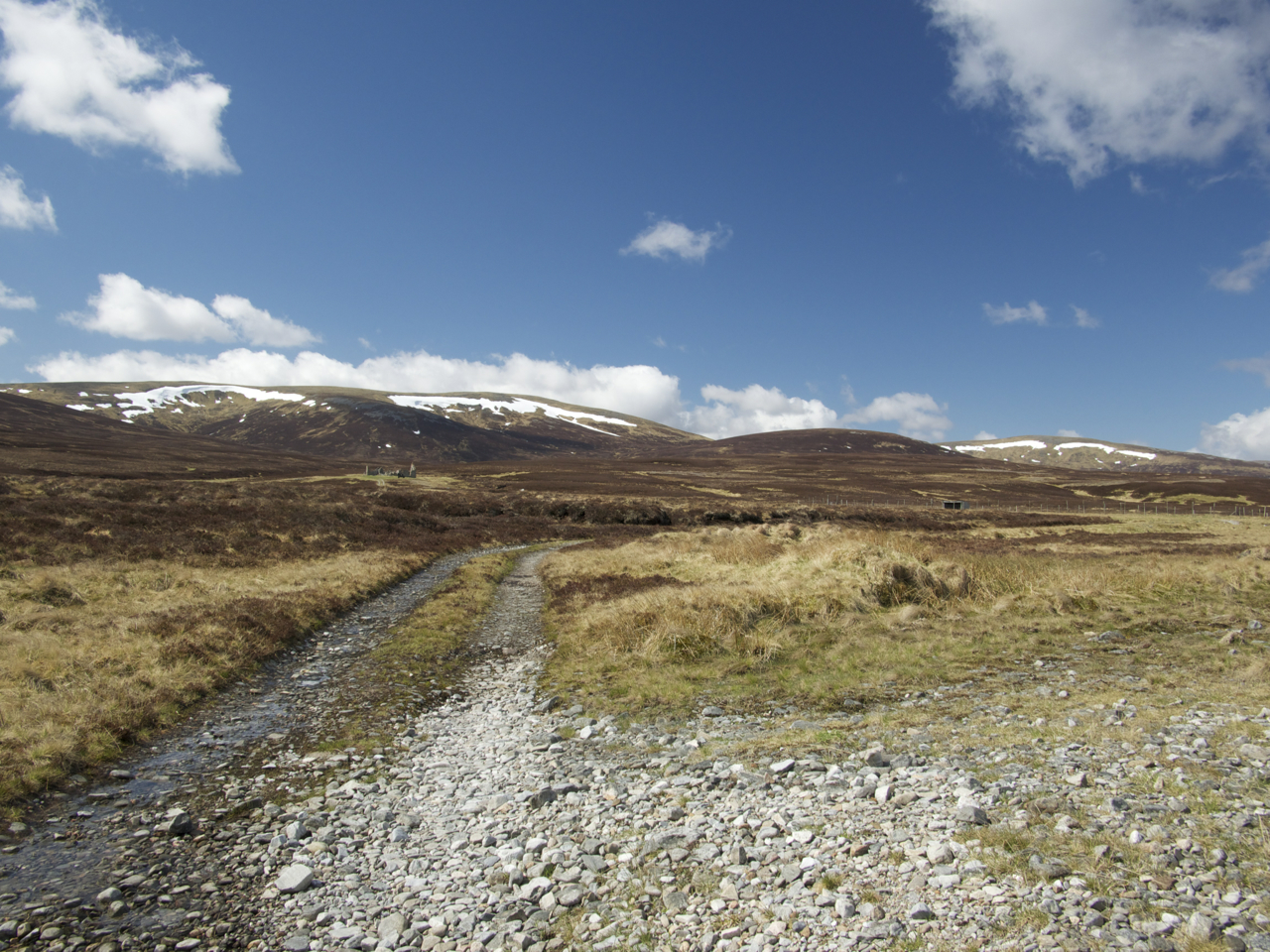
The last day of our 2013 Munro bagging campaign in the Cairngorms saw us cycling from the parking at the Linn of Dee to Derry Lodge. There we crossed the Derry Burn and continued along the path on the right bank of the tumbling waters for a further few hundred metres. When the going got too tiresome (for me at least) we left our bikes at a large tree trunk and carried on on foot.

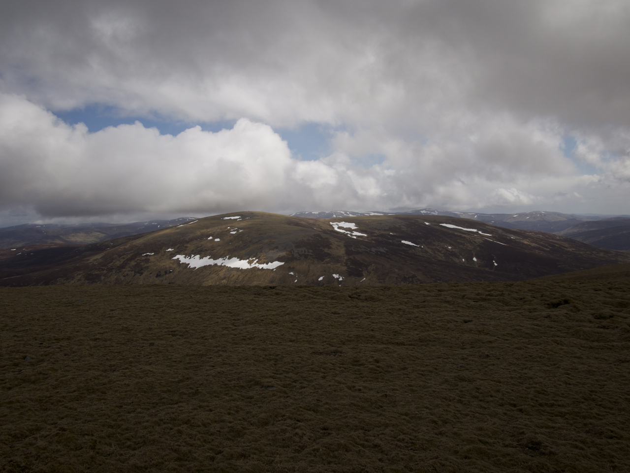
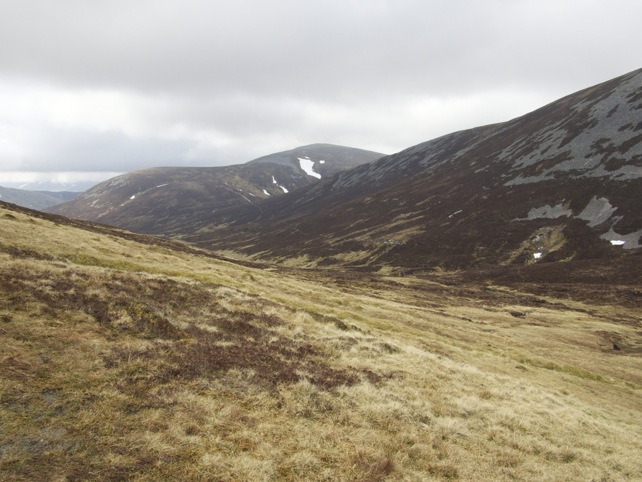
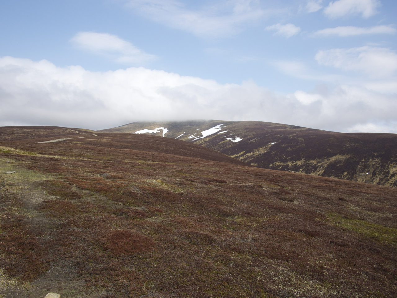
Snow had fallen two days before and the upper slopes of the hills and basically all terrain higher than 600 metres was covered in slushy snow that melted readily under the rays of a lively sun in May. But first the well-known path up towards the Lairig an Laoigh was nice, well-maintained and progress was very easy. In no time we crossed the footbridge at the south end of the grassy flats that commence when the forest is left behind. Again, this being the Cairngorm National Park, the path was excellent. We made good headway and crossed the tumbling little burn called Glas Allt Mhor – a place we would come back to later in the day:-).

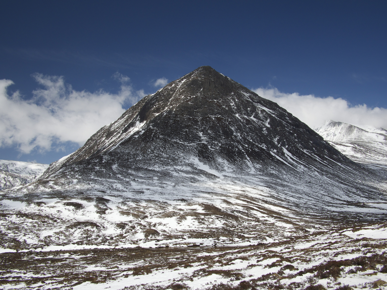
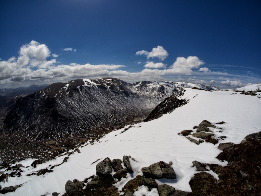
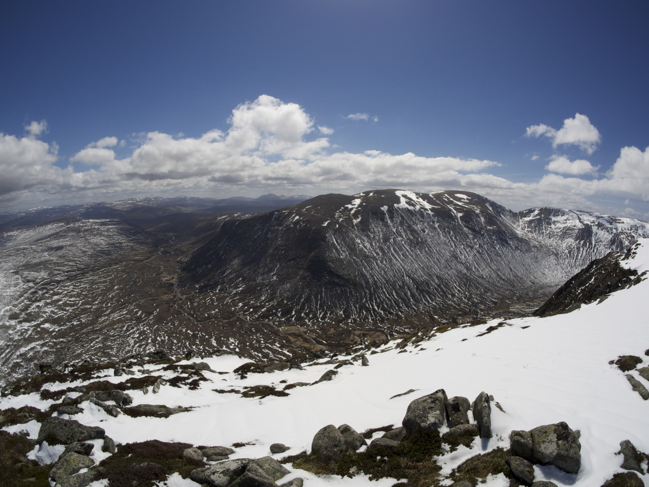
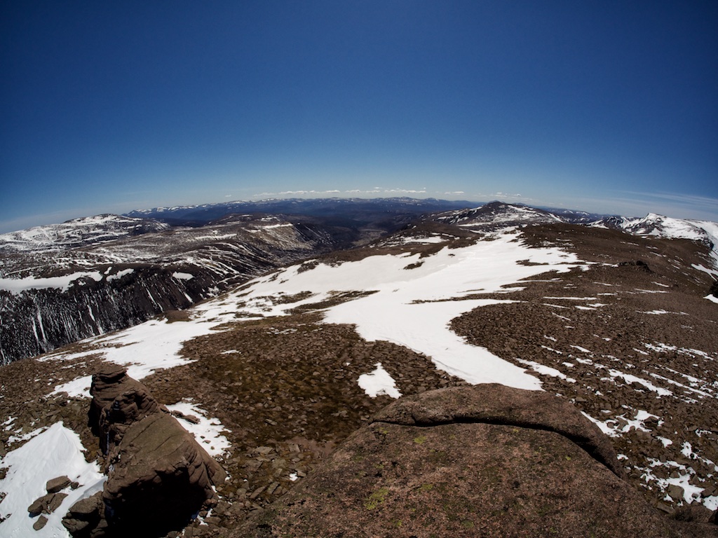
A few hundred metres past the burn the path splits and we took the left fork leading in a rising traverse towards the Hutchinson Memorial Hut in the upper corrie which is dominated by Stob Coire Etchachan and Creagan Choire Etchachan. Care was needed on this part of the hike since the high standard of maintenance means that many small draining trenches lined with stones cross the path creating deep traps well-hidden by deep snow. Then we reached the hut and continued on the steep but easy path towards Loch Etchachan which found in pristine condition: In beautiful sunshine, its surface frozen over, guarded by hills covered in white. Great, great, bloody great! This is one of the most enchanting and beautiful spots in Scotland and Frank and I both felt privileged by the fact that on our second time visiting Loch Etchachan we had our second completely sunny day. … [Read More]

2017-09-19T14:15:02+02:00May 25th, 2013|2013, 2019 - 2010, The Cairngorms|

The Devil’s Point

There is something special about the first ten or fifteen kilometres of the valley of the River Dee. First of all it’s the magnificent setting of the Cairngorm Mountains with its great summits of Carn á Mhaim, Ben Macdui, Braeriach, Sgor an Lochain Uaine, Cairn Toul and The Devilís Point enclosing the nascent river with their bulky shapes. But then it’s also the river itself as it makes its way towards Braemar and beyond over waterslides and down waterfalls that add to the remote and beautiful feeling of the place.

Today, fortunately, we could see all this. The day before when we had walked the path on the left bank of the river in our vain attempt to get to the mountains we had done so in driving snow and with hardly any visibility at all. We had hiked up the glen for about two hours, had reconsidered and then retreated to the Linn of Dee and our car. Now, with the sun shining on us, we again left our bicycles at White Bridge and hiked the path on the left bank of the River Dee towards Corrour Bothy. Progress was easy at first, Frank taking a wee bit of time for photographs. About opposite of Glen Geusachan the going got bad. The snow was very wet and with the terrain becoming flatter and the path a little less defined we had to wade through slush and spongy terrain. Progress got slower but with curses hissed from between our teeth from time to time we finally made it to the footbridge over the Dee and to the hut. This had taken us almost three hours. We rested on the dry grass in front of the hut and soaked in the views as well as the brilliant sunshine!

From there it was an exhausting but very beautiful slog up into Core Odhar which was filled with snow. The white stuff was one to two feet deep and trackless terrain was the order of the next half hour or so. Then we picked up … [Read More]

2017-09-19T14:15:03+02:00May 24th, 2013|1999, 2013, 2019 - 2010, The Cairngorms|

Monadh Mor

There is something special about the first ten or fifteen kilometres of the valley of the River Dee. First of all itís the magnificent setting of the Cairngorm Mountains with its great summits of Carn á Mhaim, Ben Macdui, Braeriach, Sgor an Lochain Uaine, Cairn Toul and The Devil’s Point enclosing the nascent river with their bulky shapes. But then it’s also the river itself as it makes its way towards Braemar and beyond over waterslides and down waterfalls that add to the remote and beautiful feeling of the place.

Today, fortunately, we could see all this. The day before when we had walked the path on the left bank of the river in our vain attempt to get to the mountains we had done so in driving snow and with hardly any visibility at all. We had hiked up the glen for about two hours, had reconsidered and then retreated to the Linn of Dee and our car. Now, with the sun shining on us, we again left our bicycles at White Bridge and hiked the path on the left bank of the River Dee towards Corrour Bothy. Progress was easy at first, Frank taking a wee bit of time for photographs. About opposite of Glen Geusachan the going got bad. The snow was very wet and with the terrain becoming flatter and the path a little less defined we had to wade through slush and spongy terrain. Progress got slower but with curses hissed from between our teeth from time to time we finally made it to the footbridge over the Dee and to the hut. This had taken us almost three hours. We rested on the dry grass in front of the hut and soaked in the views as well as the brilliant sunshine!

From there it was an exhausting but very beautiful slog up into Core Odhar which was filled with snow. The white stuff was one to two feet deep and trackless terrain was the order of the next half hour or so. Then we picked up … [Read More]

2017-09-19T14:15:03+02:00May 24th, 2013|2013, 2019 - 2010, The Cairngorms|

Beinn Bhrotain

There is something special about the first ten or fifteen kilometres of the valley of the River Dee. First of all itís the magnificent setting of the Cairngorm Mountains with its great summits of Carn á Mhaim, Ben Macdui, Braeriach, Sgor an Lochain Uaine, Cairn Toul and The Devilís Point enclosing the nascent river with their bulky shapes. But then it’s also the river itself as it makes its way towards Braemar and beyond over waterslides and down waterfalls that add to the remote and beautiful feeling of the place.

Today, fortunately, we could see all this. The day before when we had walked the path on the left bank of the river in our vain attempt to get to the mountains we had done so in driving snow and with hardly any visibility at all. We had hiked up the glen for about two hours, had reconsidered and then retreated to the Linn of Dee and our car. Now, with the sun shining on us, we again left our bicycles at White Bridge and hiked the path on the left bank of the River Dee towards Corrour Bothy. Progress was easy at first, Frank taking a wee bit of time for photographs. About opposite of Glen Geusachan the going got bad. The snow was very wet and with the terrain becoming flatter and the path a little less defined we had to wade through slush and spongy terrain. Progress got slower but with curses hissed from between our teeth from time to time we finally made it to the footbridge over the Dee and to the hut. This had taken us almost three hours. We rested on the dry grass in front of the hut and soaked in the views as well as the brilliant sunshine!

From there it was an exhausting but very beautiful slog up into Core Odhar which was filled with snow. The white stuff was one to two feet deep and trackless terrain was the order of the next half hour or so. Then we picked up … [Read More]

2017-09-19T14:15:03+02:00May 24th, 2013|2013, 2019 - 2010, The Cairngorms|

Carn an Fhidhleir

Whoever invented the bicycle probably did not have the idea in mind of getting into remote mountain country more quickly than on foot. And Land Rover tracks did not exist then either since Land Rovers are even younger than the bicycle. These thoughts did – I admit – not occur to us when we left the Linn of Dee parking and cycled on the Land Rover track towards White Bridge one sunny but breezy morning in May 2013. With the wind blowing in our faces progress was a little slower than we had hoped for. Nonetheless we ticked of mile after mile in a steady fashion. Soon Glen Geldie was reached and we turned off to the right. The track only climbs in a moderate way and apart from one or two short steepish sections the going was very good on firm dirt and gravel.

Then the ford over the Geldie Burn came into view. We decided to leave the cycles on the left bank of the river, crossed the Geldie Burn using stepping stones and walked the 500 m or so to the ruins of Geldie Lodge. From there a very well-maintained track though empty land with alternating stretches of grass and heather formed the next leg of the hike. Where the path ends at the Allt a’Chaorainn the more or less trackless continuation through high heather began. The terrain rose gently at first then more steeply towards Carn an Fhidhleir’s north ridge. It started to snow and in the really strong wind this felt quite wintry. Then the shower was over and we gained the crest of the broad ridge of the Fiddler’s hill. The summit was not too far off, about a kilometre or so.

At the summit we paused for a very short while only since conditions were not really cosy at all: Strong wind chill, sleet and beckoning clouds. So on we went following the ridge in a southerly direction until the beallach between point 906m and An Sgarsoch’s west ridge was below us on the left-hand … [Read More]

2017-09-19T14:15:03+02:00May 22nd, 2013|2013, 2019 - 2010, Glen Garry to Braemar|

An Sgarsoch

Whoever invented the bicycle probably did not have the idea in mind of getting into remote mountain country more quickly than on foot. And Land Rover tracks did not exist then either since Land Rovers are even younger than the bicycle. These thoughts did – I admit – not occur to us when we left the Linn of Dee parking and cycled on the Land Rover track towards White Bridge one sunny but breezy morning in May 2013. With the wind blowing in our faces progress was a little slower than we had hoped for. Nonetheless we ticked of mile after mile in a steady fashion. Soon Glen Geldie was reached and we turned off to the right. The track only climbs in a moderate way and apart from one or two short steepish sections the going was very good on firm dirt and gravel.

Then the ford over the Geldie Burn came into view. We decided to leave the cycles on the left bank of the river, crossed the Geldie Burn using stepping stones and walked the 500 m or so to the ruins of Geldie Lodge. From there a very well-maintained track though empty land with alternating stretches of grass and heather formed the next leg of the hike. Where the path ends at the Allt a’Chaorainn the more or less trackless continuation through high heather began. The terrain rose gently at first then more steeply towards Carn an Fhidhleir’s north ridge. It started to snow and in the really strong wind this felt quite wintry. Then the shower was over and we gained the crest of the broad ridge of the Fiddler’s hill. The summit was not too far off, about a kilometre or so.

At the summit we paused for a very short while only since conditions were not really cosy at all: Strong wind chill, sleet and beckoning clouds. So on we went following the ridge in a southerly direction until the beallach between point 906m and An Sgarsoch’s west ridge was below us on the left-hand … [Read More]

2017-09-19T14:15:03+02:00May 22nd, 2013|2013, 2019 - 2010, Glen Garry to Braemar|

Beinn a’Chaorainn

Describing the start of this tour is difficult for me. Not because of maybe hazy recollections of it. Not because I have an emotional blockade. And not because I lost my books and maps which serve as necessary references. No. It is difficult for me to describe the start of the tour because I have written at least three more times about parking the car at the Linn of Dee and cycling to Derry Lodge. One could say that I lack a certain enthusiasm for describing the identical approach again and again and again.

Anyway, when we had reached Derry Lodge, for the first time in our hiking history we opted for the path on the left bank of the Derry Burn. This was a nice variation. The wooded lower reaches of Glen Derry are really enchanting with their old trees many of them Scots Pines. The going on the well-built track was easy and in no time we reached the spot where a small cairn marks the beginning of a little path that climbs up the rather gentle slope leading to the saddle between Meall an Lundain and Beinn Bhreac. First the going was “interesting” due to some rather wet and boggy sections in the path. Then, when Frank and I had gained more height, the going improved considerably. After some time we reached the section of the path where it abuts more or less abruptly at the steepish section of Beinn Bhreac’s south ridge. Here the climb became a little more strenuous for about 20 minutes or half an hour as we climbed up steep grass slopes. Then the gradient levelled off and we were on the stony plateau between the two tops of this hill, the lower one 927m, the higher one, the summit, 931m tall.

At the summit of Beinn Bhreac we sat in the sunshine and marvelled at the panorama. Most prominent of course were the western slopes of giant Beinn a’ Bhuird. To the west the east faces of the Central Cairngorm hills rose up boldly. … [Read More]

2017-09-19T14:15:03+02:00May 21st, 2013|2013, 2019 - 2010, The Cairngorms|

Beinn Bhreac

Describing the start of this tour is difficult for me. Not because of maybe hazy recollections of it. Not because I have an emotional blockade. And not because I lost my books and maps which serve as necessary references. No. It is difficult for me to describe the start of the tour because I have written at least three more times about parking the car at the Linn of Dee and cycling to Derry Lodge. One could say that I lack a certain enthusiasm for describing the identical approach again and again and again.

Anyway, when we had reached Derry Lodge, for the first time in our hiking history we opted for the path on the left bank of the Derry Burn. This was a nice variation. The wooded lower reaches of Glen Derry are really enchanting with their old trees many of them Scots Pines. The going on the well-built track was easy and in no time we reached the spot where a small cairn marks the beginning of a little path that climbs up the rather gentle slope leading to the saddle between Meall an Lundain and Beinn Bhreac. First the going was “interesting” due to some rather wet and boggy sections in the path. Then, when Frank and I had gained more height, the going improved considerably. After some time we reached the section of the path where it abuts more or less abruptly at the steepish section of Beinn Bhreac’s south ridge. Here the climb became a little more strenuous for about 20 minutes or half an hour as we climbed up steep grass slopes. Then the gradient levelled off and we were on the stony plateau between the two tops of this hill, the lower one 927m, the higher one, the summit, 931m tall.

At the summit of Beinn Bhreac we sat in the sunshine and marvelled at the panorama. Most prominent of course were the western slopes of giant Beinn a’ Bhuird. To the west the east faces of the Central Cairngorm hills rose up boldly. … [Read More]

2017-09-19T14:15:03+02:00May 21st, 2013|2013, 2019 - 2010, The Cairngorms|

Carn an Righ

We had seen these two hills when we had visited An Socach, Beinn Iutharn Mhor and Carn Bhac years before starting that long tour from Inverey. This time on a beautiful morning in May we approached these rather remote hills from the Spittal of Glenshee. We left our car at Dalmunzie Hotel of course not without having paid our parking fee at the reception. From the Hotel Frank and I and three English hill walkers and their dog walked up Glen Lochsie using the Land Rover track which first runs along left bank and then the right bank of the burn. A hundred metres before the ruins of Glenlochsie Lodge we had to wade the Glen Lochsie Burn since it carried enough water for us not being able to jump from stepping stone to stepping stone. One of the Englishmen was brave enough for the risky jump, though, and made it alright!

At the ruins the Land Rover track becomes quite steep for a while as it climbs the broad south ridge of Glas Tulaichean. Once the 800 metre contour is reached the way to the summit becomes quite obvious as the ridge levels off and the view opens up. The sun had given way to high clouds and a strong wind greeted us on the upper parts of the hill. Getting to the summit is absolutely easy since the Land Rover track runs up to the 1000m contour and the cairn is only few dozen metres higher. The summit was covered in clouds on and off.

We rested a few minutes at the cairn and then continued down the north ridge of the hill. At a height of about 900m we turned left off the ridge, crossed some boggy terrain in Gleann Mhor and the burn and picked up the path which runs along the southern flank of Mam nan Cairn. There’s a lower and an upper variant of the path, which are both quite boggy all the way to the point where they unite a few hundred metres before the … [Read More]

2017-09-19T14:15:03+02:00May 20th, 2013|2013, 2019 - 2010, Glen Garry to Braemar|

Glas Tulaichean

We had seen these two hills when we had visited An Socach, Beinn Iutharn Mhor and Carn Bhac years before starting that long tour from Inverey. This time on a beautiful morning in May we approached these rather remote hills from the Spittal of Glenshee. We left our car at Dalmunzie Hotel of course not without having paid our parking fee at the reception. From the Hotel Frank and I and three English hill walkers and their dog walked up Glen Lochsie using the Land Rover track which first runs along left bank and then the right bank of the burn. A hundred metres before the ruins of Glenlochsie Lodge we had to wade the Glen Lochsie Burn since it carried enough water for us not being able to jump from stepping stone to stepping stone. One of the Englishmen was brave enough for the risky jump, though, and made it alright!

At the ruins the Land Rover track becomes quite steep for a while as it climbs the broad south ridge of Glas Tulaichean. Once the 800 metre contour is reached the way to the summit becomes quite obvious as the ridge levels off and the view opens up. The sun had given way to high clouds and a strong wind greeted us on the upper parts of the hill. Getting to the summit is absolutely easy since the Land Rover track runs up to the 1000m contour and the cairn is only few dozen metres higher. The summit was covered in clouds on and off.

We rested a few minutes at the cairn and then continued down the north ridge of the hill. At a height of about 900m we turned left off the ridge, crossed some boggy terrain in Gleann Mhor and the burn and picked up the path which runs along the southern flank of Mam nan Cairn. There’s a lower and an upper variant of the path, which are both quite boggy all the way to the point where they unite a few hundred metres before the … [Read More]

2017-09-19T14:15:03+02:00May 20th, 2013|2013, 2019 - 2010, Loch Lomond to Loch Tay|
Go to Top