Beinn Mhanach

30 May 2014 was Frank’s 48th birthday and the tour planning we had done had a singular present in store for him: The solitary Munro hidden way back in Gleann Ach’Inns Challein where the Allt Kinglass rules and the sheep-hating poet Duncan Mac Intyre lived at Ais an t-Sithean: Beinn Mhanach.

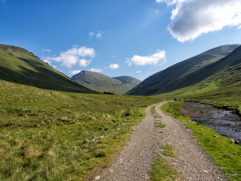
But first we needed to get there. We parked the car at the large lay-by on the A82 where access to Auch Glen and Auch Farm is possible by means of a paved private road. After having got our act together we set off towards Auch Farm, crossed the West Highland Way and followed the track below the (probably) second most famous railway viaduct in Scotland.

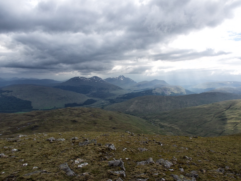
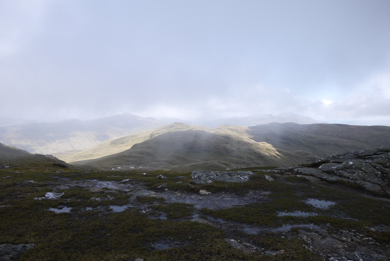
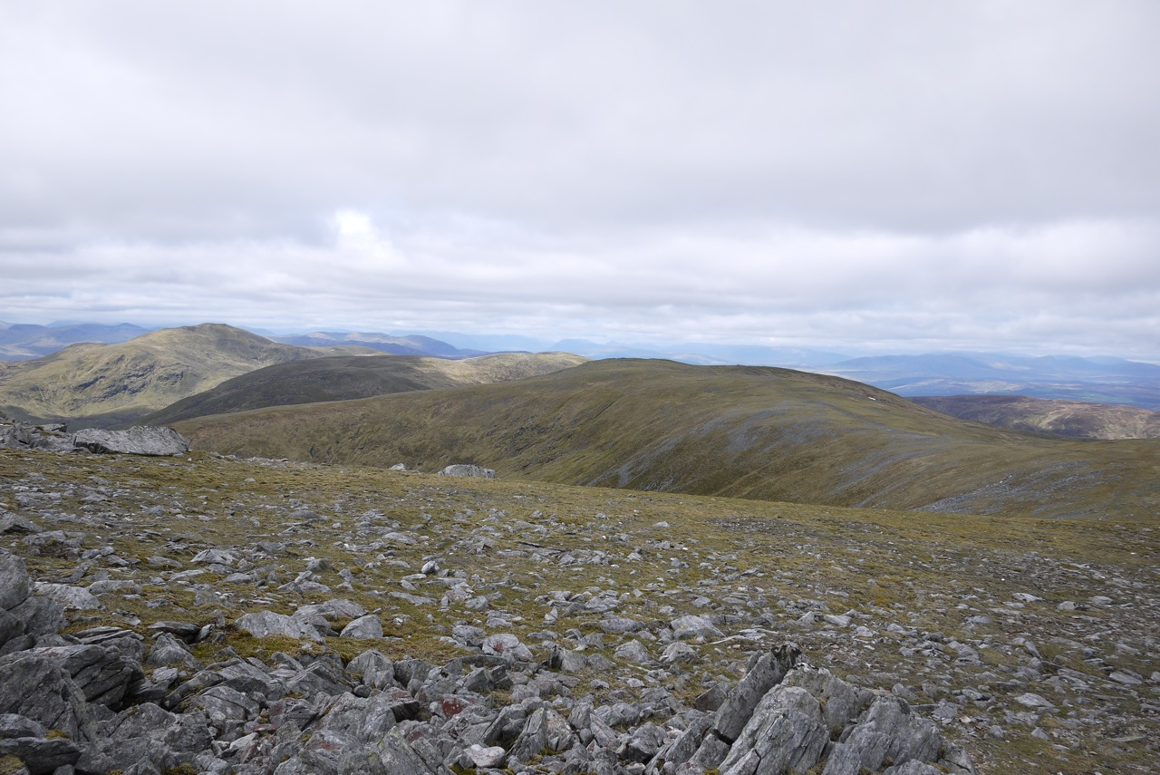
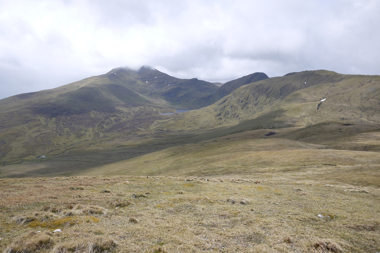
The landrover track beside the wide Allt Kinglass allowed for easy progress and we made good headway on this very sunny day. Frank and I crossed the Allt Kinglass dryshod at several fords before we reached Ais an t-Sithean which nowadays boasts a few sheep fanks, a more or less derelict hut and a nice collection of ice age drumlins. Not extremely romantic but in the sunshine the spot was inviting enough. At a T-junction in the landrover track we turned right (east) and continued towards the bealach leading to Loch Lyon. Once the bealach was reached we took a short break sitting in the sunshine beside the tumbling burn coming down from the bealach between Beinn a Chuirn and Beinn Mhanach 450 metres further up.

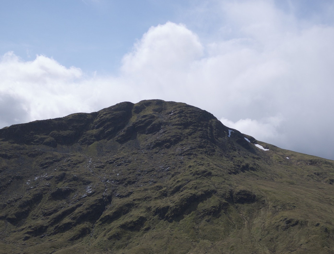
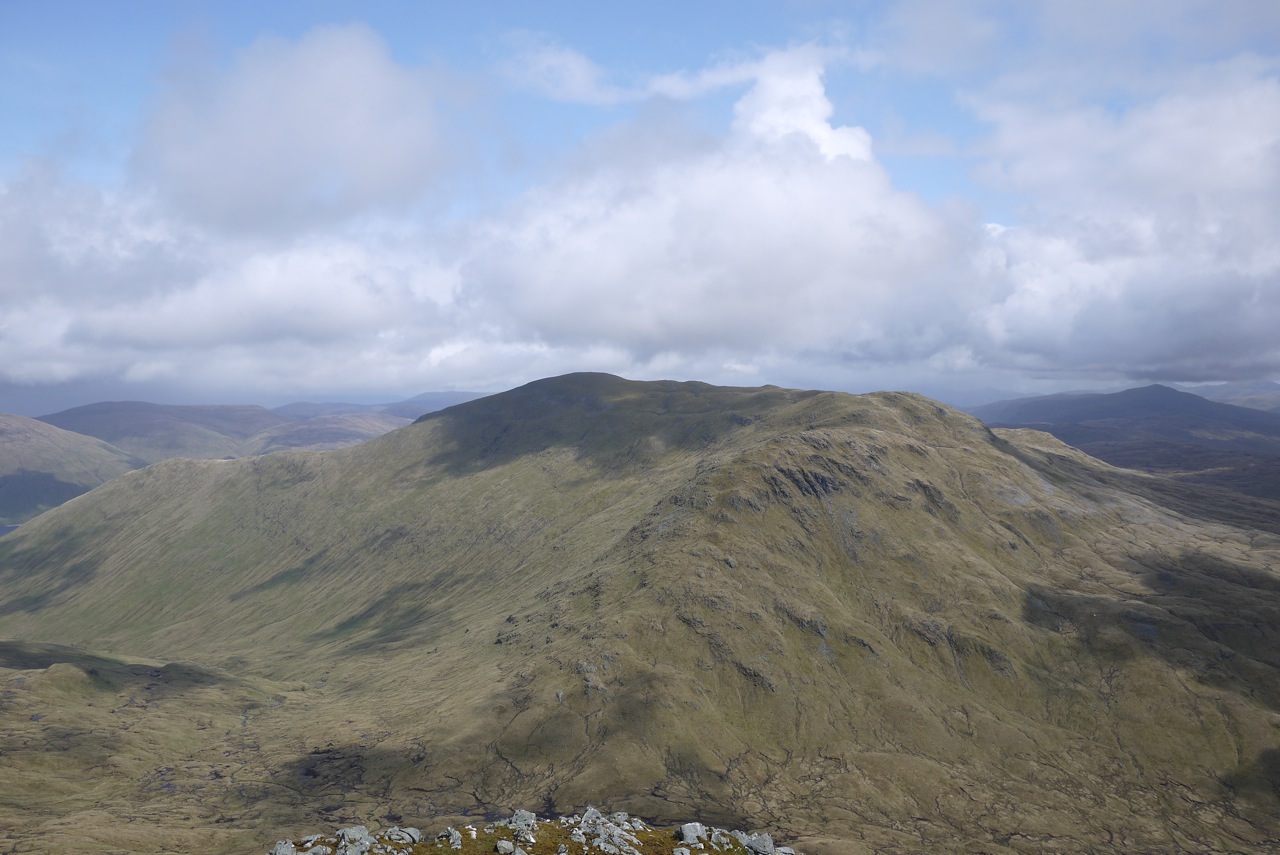
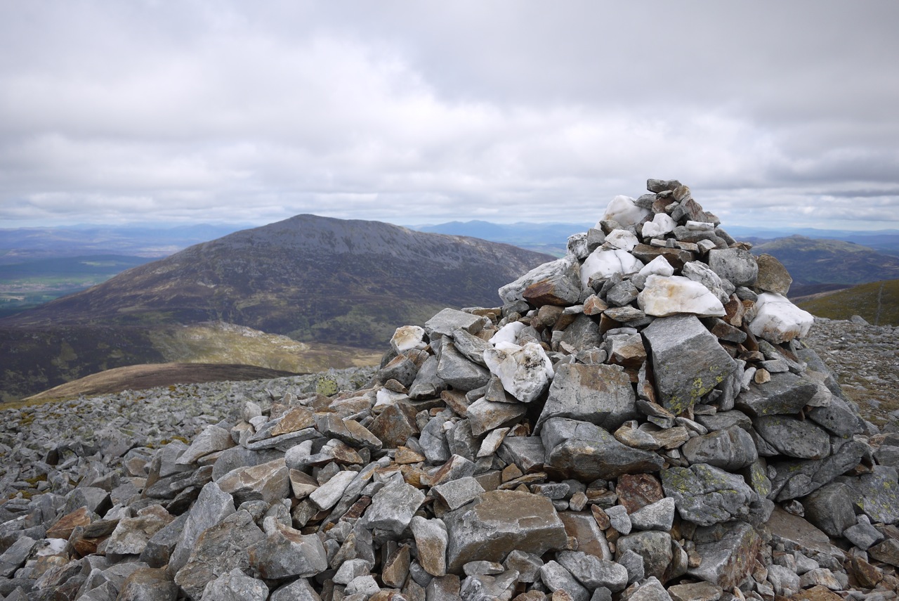
Then we started to climb the very steep hillside towards this bealach following a more or less distinct path that unrelentingly winds its way beside the burn and over steep grass slopes towards the hill tops. After some considerable effort we reached the bealach and continued over easy grass slopes towards the plateau-ish summit of Beinn Mhanach. At the cairn we rested for a while in the bright sunshine enjoying the great views! Then – with nothing better to do but shopping for food in Fort William and driving to our cottage in Laggan – we returned to the A … [Read More]

2021-05-30T15:04:08+02:00May 30th, 2014|2014, 2019 - 2010, The River Tay to Rannoch Moor|

Ben Challum

29 May 2015 saw us arrive at Edinburgh Airport from Cologne and Berlin on time and full of anticipation. The weather was much better than we had expected it to be. The waiting line at the car rental was short and off we went quite swiftly.

The first hill of the May/June 2015 “campaign” was to be Ben Challum which is a good hill for an afternoon hike since its ascent from Kirkton Farm is straightforward and very quickly done. The choice of Kirkton as the starting point also signalled our decision to skip the slightly longer but likely more interesting approach to the hill via its north-east ridge due to time constraints imposed upon us by the advanced hour of the day. We reached the farm buildings using the minor road that leaves the A82 a few kilometres west of Crianlarich. Right in front of the Farm the West Highland Way runs parallel to the railway line. We parked the Vauxhall in a little parking provided by the farmer (Thanks!). Then the stuff we needed for the short hike was torn from our suitcases and disappeared into the rucksacks. Hiking clothes were found, put on and boots were laced.

After a short glance at the ruins of St. Fillan’s Priory we took the Land Rover track leading uphill towards the rail tracks. We crossed the tracks and continued uphill for a few dozen metres until we picked up traces of a path and later the path proper which we were able to follow all the way to the summit of Beinn Challum. But before we got there seemingly endless slopes of grass interspersed with two deer fences, the occasional squishy section and the odd peat hag needed to be climbed.

This was no problem, though, since the weather had been mostly dry the days before we arrived in Scotland. The views became more extensive as height was gained. An overcast day with high clouds and the occasional ray of brilliant sunlight. Not the worst hillwalking weather at all.

Then the south top of … [Read More]

2017-09-19T14:15:02+02:00May 29th, 2014|2014, 2019 - 2010, The River Tay to Rannoch Moor|

Sgiath Chuil

These are no hills you will find within the top 10 of most Munro baggers list of favourite hills. But you need to climb them and they are located in beautiful Glen Lochay. From our cottage in Glen Lyon Frank and I drove to Kenknock via the private Glen Lyon to Glen Lochay hydro road. This was the third time we used this connection between the two glens and we already knew how to circumnavigate the deepest potholes.

At Kenknock we crossed the River Lochay and followed the land-rover track leading through the fir plantation. At the top end of the plantation, close to Where the pipeline emerges from the ground, we headed due south into the open grassy corrie holding the Allt Innisdaimh. First we erred to far to the left (east) but then crossed the Allt which was in spate after the rain of the last few days. Even though the Allt Innisdaimh is not a really wide burn the crossing was not too easy and we had to walk upstream for a few hundred metres to find a suitable spot. A little later we were on the back of the north ridge of Meall a’Churain. A steady plod up this ridge (or rather, this whale back) helped to gain height quickly. The steeper upper slopes were covered in clouds as usual in 2011. Then all the efforts ended and the path we had followed deposited us at the summit of Meall a’Churain. Of course we did not stop for long but continued along the ridge to the summit crags of Sgiath Chuil, where we hid from the strongish wind behind some rocks and had a short break. The clouds cleared the summit and we enjoyed the unimpeded views down to Glen Dochart and over to Ben More. Very fine.

Then we retraced our steps and headed due north along the ridge. After maybe 300 metres we turned left and headed down the very steep grass slopes into the wide grassy and boggy corrie between Sgiath Chuil and Meall Ghlas. … [Read More]

2017-09-19T14:16:16+02:00May 20th, 2011|2011, 2019 - 2010, The River Tay to Rannoch Moor|

Meall Glas

These are no hills you will find within the top 10 of most Munro baggers list of favourite hills. But you need to climb them and they are located in beautiful Glen Lochay. From our cottage in Glen Lyon Frank and I drove to Kenknock via the private Glen Lyon to Glen Lochay hydro road. This was the third time we used this connection between the two glens and we already knew how to circumnavigate the deepest potholes :-).

At Kenknock we crossed the River Lochay and followed the land-rover track leading through the fir plantation. At the top end of the plantation, close to Where the pipeline emerges from the ground, we headed due south into the open grassy corrie holding the Allt Innisdaimh. First we erred to far to the left (east) but then crossed the Allt which was in spate after the rain of the last few days. Even though the Allt Innisdaimh is not a really wide burn the crossing was not too easy and we had to walk upstream for a few hundred metres to find a suitable spot. A little later we were on the back of the north ridge of Meall a’Churain. A steady plod up this ridge (or rather, this whale back) helped to gain height quickly. The steeper upper slopes were covered in clouds – as usual in 2011 :-(. Then all the efforts ended and the path we had followed deposited us at the summit of Meall a’Churain. Of course we did not stop for long but continued along the ridge to the summit crags of Sgiath Chuil, where we hid from the strongish wind behind some rocks and had a short break. The clouds cleared the summit and we enjoyed the unimpeded views down to Glen Dochart and over to Ben More. Very fine.

Then we retraced our steps and headed due north along the ridge. After maybe 300 metres we turned left and headed down the very steep grass slopes into the wide grassy and boggy corrie between Sgiath Chuil … [Read More]

2021-10-16T13:07:06+02:00May 20th, 2011|2011, 2019 - 2010, The River Tay to Rannoch Moor|

Creag Mhor

In my eyes these two hills were a pair I had been looking forward to since I had first seen the eastern flank of Beinn Heasgarnich while driving on the private hydro road that connects Glen Lyon and Glen Lochay a few days earlier. This day saw Frank and me park our car where a land rover track/hydro track branches off in a westerly direction from the private hydro road about 150 m above Kenknock.

We walked along the track 200m above Glen Lochay passing below the crags of Creagan Fhearchair on the steep southern slopes of Beinn Heasgarnich. Progress was easy of course and views of Sgiath Chuill and Meall Glas on the south side of Glen Lochay were great, even though these hills might not be of the stuff that gets you twitching in anticipation.

After an hour and five kilometres we reached the bridge over the Allt Batavaim where a path climbs the grassy hillside in a north-north-westerly direction into the corrie below Sron nan Eun (837m). Gradually ascending towards that ridge we soon decided to head for the higher and craggier ground further up on the left, weaving our way through bands of crags. Once on the ridge the view into beautiful Coire cheaththaich more than compensated for the effort of the steep ascent before. You can’t miss the path on the ridge leading towards the final 250 rise to the first Munro of the day Creag Mhor, which is a fine pointed summit with considerable crags girting its upper parts — fine and pointed at least by Glen Lyon and Glen Lochay standards. At the summit the obligatory break was held with sandwiches, water, chocolate and beautiful views of Beinn Heasgarnich, Beinn Challum, Beinn Mhanach, and the summit of Beinn Dorain a number of corries and the Auch Glen away.

From Creag Mhor’s summit we headed west then north down a broad grassy ridge interspersed with rocks. From the beallach between the Munro and Meall Tionail we strolled down easy, almost lush grass slopes to Bealach … [Read More]

2017-09-19T14:16:16+02:00May 19th, 2011|2011, 2019 - 2010, The River Tay to Rannoch Moor|

Beinn Heasgarnich

In my eyes these two hills were a pair I had been looking forward to since I had first seen the eastern flank of Beinn Heasgarnich while driving on the private hydro road that connects Glen Lyon and Glen Lochay a few days earlier. This day saw Frank and me park our car where a land rover track/hydro track branches off in a westerly direction from the private hydro road about 150 m above Kenknock.

We walked along the track 200m above Glen Lochay passing below the crags of Creagan Fhearchair on the steep southern slopes of Beinn Heasgarnich. Progress was easy of course and views of Sgiath Chuill and Meall Glas on the south side of Glen Lochay were great, even though these hills might not be of the stuff that gets you twitching in anticipation.

After an hour and five kilometres we reached the bridge over the Allt Batavaim where a path climbs the grassy hillside in a north-north-westerly direction into the corrie below Sron nan Eun (837m). Gradually ascending towards that ridge we soon decided to head for the higher and craggier ground further up on the left, weaving our way through bands of crags. Once on the ridge the view into beautiful Coire cheaththaich more than compensated for the effort of the steep ascent before. You can’t miss the path on the ridge leading towards the final 250 rise to the first Munro of the day Creag Mhor, which is a fine pointed summit with considerable crags girting its upper parts — fine and pointed at least by Glen Lyon and Glen Lochay standards. At the summit the obligatory break was held with sandwiches, water, chocolate and beautiful views of Beinn Heasgarnich, Beinn Challum, Beinn Mhanach, and the summit of Beinn Dorain a number of corries and the Auch Glen away.

From Creag Mhor’s summit we headed west then north down a broad grassy ridge interspersed with rocks. From the beallach between the Munro and Meall Tionail we strolled down easy, almost lush grass slopes to Bealach … [Read More]

2017-09-19T14:16:16+02:00May 19th, 2011|2011, 2019 - 2010, The River Tay to Rannoch Moor|

Meall Garbh

This round of four Munros was the main reason for us renting a cottage on the Roro estate in Glen Lyon for the 2011 bagging exercise. Located on the south bank of the River Lyon we had an unobstructed view of Carn Gorm’s western and southern side from the cottage. Quite a bulk of a mountain.

Even though the hill was very close Frank and I nonetheless drove the four kilometres to the start of the hike by car. We set out from the parking in Invervar, crossed the street, opened the gate and were on our way. Shortly after having reached the rim of the forest we left the land rover track behind us and climbed due east on a good stalkers path on the southern flank of the ridge leading to Meall nan Aighean our first Munro of the day. The path’s good layout allowed for easy progress. Higher up the going became a little less easy since there were some steeper sections and the path tended to disappear and reappear. Soon, however, the path deposited us on the crest of the ridge at an altitude of about 550 to 600m. From there it was a steady walk up the ridge which tended to level off once the summit got close.

The terrain being easy we enjoyed the views of the Lawers range to the south and of the ridge walk that lay ahead of us to the north. At the summit of Meall nan Aighean we paused for some cookies and water. Then we retraced the steps of our ascent for a few hundred metres. Soon, however, another track led us in a northerly direction and delivered us at the bottom of the south-eastern flank of Carn Mairg which is a steep grass slope strewn with boulders and interspersed with rubble and some scree. On this easy ridge walk this was the day’s only intimation of more difficult terrain. Nice for a change! Once on the wide plateau-ish summit slopes of Carn Mairg Frank and I soon reached the … [Read More]

2017-09-19T14:16:16+02:00May 17th, 2011|2011, 2019 - 2010, The River Tay to Rannoch Moor|

Meall nan Aighean

This round of four Munros was the main reason for us renting a cottage on the Roro estate in Glen Lyon for the 2011 bagging exercise. Located on the south bank of the River Lyon we had an unobstructed view of Carn Gorm’s western and southern side from the cottage. Quite a bulk of a mountain.Even though the hill was very close Frank and I nonetheless drove the four kilometres to the start of the hike by car. We set out from the parking in Invervar, crossed the street, opened the gate and were on our way. Shortly after having reached the rim of the forest we left the land rover track behind us and climbed due east on a good stalkers path on the southern flank of the ridge leading to Meall nan Aighean our first Munro of the day. The path’s good layout allowed for easy progress. Higher up the going became a little less easy since there were some steeper sections and the path tended to disappear and reappear. Soon, however, the path deposited us on the crest of the ridge at an altitude of about 550 to 600m. From there it was a steady walk up the ridge which tended to level off once the summit got close.

The terrain being easy we enjoyed the views of the Lawers range to the south and of the ridge walk that lay ahead of us to the north. At the summit of Meall nan Aighean we paused for some cookies and water. Then we retraced the steps of our ascent for a few hundred metres. Soon, however, another track led us in a northerly direction and delivered us at the bottom of the south-eastern flank of Carn Mairg which is a steep grass slope strewn with boulders and interspersed with rubble and some scree. On this easy ridge walk this was the day’s only intimation of more difficult terrain. Nice for a change! Once on the wide plateau-ish summit slopes of Carn Mairg Frank and I soon reached … [Read More]

2017-09-19T14:16:16+02:00May 17th, 2011|2011, 2019 - 2010, The River Tay to Rannoch Moor|

Meall Greigh

2011 Staying in Glen Lyon on the Roro Estate allowed us to gain easy access to two great foursomes. One to the north – The Glen Lyon Four – and one to the south – Meall Greigh to Ben Lawers.

The tour of the second row of four Munros was the aim of this day. Staying on the private road along the south bank of the River Lyon we drove our car to Roromore. Works close by forced us to leave the car half a kilometre west of the farm. We followed the track past Roromore through the meadows along the River Lyon for a few kilometres, reached the large tree plantation south of the track and stayed on the track until we reached Inverinain. Maybe two hundred metres past the cottage a steep and caterpillar-marked track climbs diagonally through the trees for about 200m. At a height of 350 to 400m it turns due west and leads around the crags of Creag Dubh. Then the track zig-zags up to a height of 550m and peters out on grassy and and squishy terrain. Heading southeast first and gradually in a more southerly direction Frank and I climbed the north ridge of Meall Greigh more or less sticking to the obvious line of fence posts. The combination of undulating terrain and strong westerly winds made progress a little slower and energy consuming than we had expected. But the views were good and especially the dark north-east face of Meall Garbh was interesting. Before final pull to Meall Greigh we paused and replenished our batteries.

After that the main east-west ridge was not far away anymore and we were greeted by very strong winds indeed. Walking upright to Munro No. 1 of the day was not easy at all. However, finally we both touched the summit cairn and immediately retraced our steps to the beallach between Meall Greigh and Meall Garbh. There the winds eased off a bit since the bulk of Meall Garbh protected us from the worst. Up the well-defined and east … [Read More]

2017-09-19T14:16:16+02:00May 17th, 2011|2011, 2019 - 2010, The River Tay to Rannoch Moor|

Carn Mairg

This round of four Munros was the main reason for us renting a cottage on the Roro estate in Glen Lyon for the 2011 bagging exercise. Located on the south bank of the River Lyon we had an unobstructed view of Carn Gorm’s western and southern side from the cottage. Quite a bulk of a mountain.

Even though the hill was very close Frank and I nonetheless drove the four kilometres to the start of the hike by car. We set out from the parking in Invervar, crossed the street, opened the gate and were on our way. Shortly after having reached the rim of the forest we left the land rover track behind us and climbed due east on a good stalkers path on the southern flank of the ridge leading to Meall nan Aighean our first Munro of the day. The path’s good layout allowed for easy progress. Higher up the going became a little less easy since there were some steeper sections and the path tended to disappear and reappear. Soon, however, the path deposited us on the crest of the ridge at an altitude of about 550 to 600m. From there it was a steady walk up the ridge which tended to level off once the summit got close.

The terrain being easy we enjoyed the views of the Lawers range to the south and of the ridge walk that lay ahead of us to the north. At the summit of Meall nan Aighean we paused for some cookies and water. Then we retraced the steps of our ascent for a few hundred metres. Soon, however, another track led us in a northerly direction and delivered us at the bottom of the south-eastern flank of Carn Mairg which is a steep grass slope strewn with boulders and interspersed with rubble and some scree. On this easy ridge walk this was the day’s only intimation of more difficult terrain. Nice for a change! Once on the wide plateau-ish summit slopes of Carn Mairg Frank and I soon reached … [Read More]

2017-09-19T14:16:16+02:00May 17th, 2011|2011, 2019 - 2010, The River Tay to Rannoch Moor|
Go to Top