Beinn Dearg

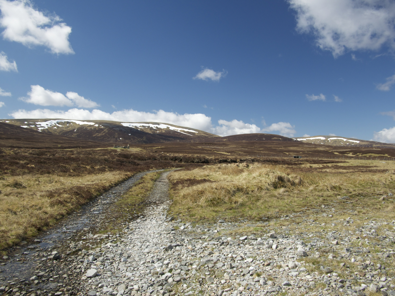
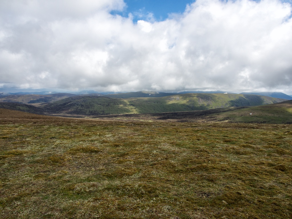
A tramp along long land rover tracks on a warm day in early June was on the agenda. Beinn Dearg from Blair Atholl was the goal of the hike. We had left our cosy and comfortable cottage in Laggan for good and had headed south on the A9 to Blair Atholl where we parked our car in the hikers’ parking at Old Bridge of Tilt – not without having recceed the road to Old Blair beforehand and having found no place to leave the car. So up the private road to Old Blair we walked and soon entered the forest following the track high above the left bank of the Banvie Burn. We were overtaken by a couple of people giving their horses some exercise shortly before the track left behind the trees for good. It was quite warm and there was no protection from the sunshine anymore for hours on end. Frank and I sweated profusely and made good progress on the land rover track leading to the Lady March Cairn. From there the tramp on the track continued gaining metre after metre in altitude. Then the terrain levelled out before we lost 50-70 metres before reaching the bothy at the Allt Sheicheanchan.

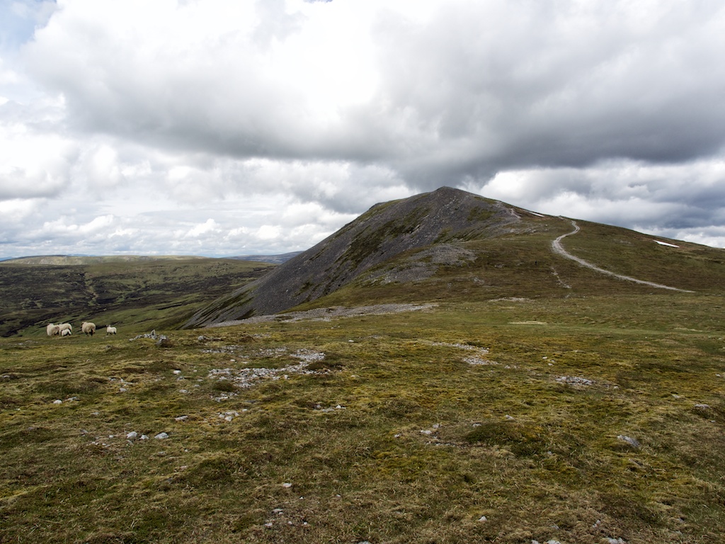
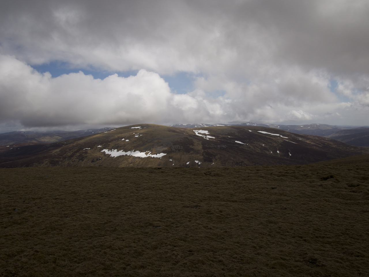
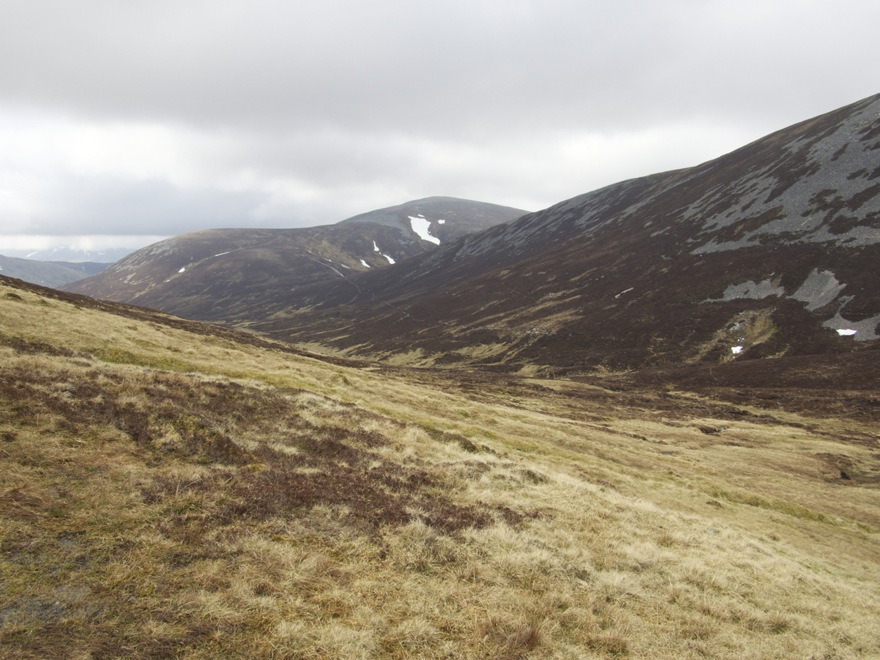
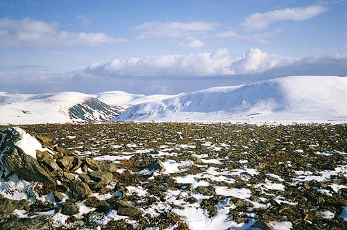
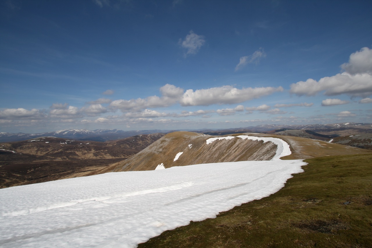
A rougher track led along the right bank of this burn to an altitude of about 600-650 metres. Where the track crossed the burn and took a sharp turn right we picked up the path climbing the south slopes of Beinn Dearg’s outlier Meall Dubh nan Dearcag and leading to more level terrain on the whale back of the mountain. We struck a more or less direct line from there to the gravel-strewn and stony summit of Beinn Dearg which was nicely visible a mile ahead. On the way to the summit we walked over another intermediate grassy/heathery bump and met a few other walkers with whom some words on the perfect conditions of this marvellous day were exchanged. Soon we rested at the summit cairn and enjoyed the views. A cool wind was blowing at … [Read More]

2017-09-19T14:15:00+02:00June 6th, 2014|2014, 2019 - 2010, Glen Garry to Braemar|

Carn a’Chlamain

A “good afternoon walk” from Forest Lodge on a stalkers path is what Mr McNeish proposes in “The Munros – Scotland’s Highest Mountains” for this remote hill. Not without adding that alternatively one could walk in from Old Blair and “make a day of it”. Just how one is supposed to make it to Forest Lodge before one can enjoy the afternoon walk is left open but one can assume that Mr McNeish might opt for staying at the lodge, flying in by helicopter, hitch-hiking a ride on somebody’s Land Rover or using some other means of transport to get to the Lodge.

Frank and I rode on our bicycles and chose the less scenic ascent of the hill by means of the Land Rover track from Clachglas. The bicycle ride up beautiful Glen Tilt was fun and the perfect condition of the dirt road up the glen made things quite easy. We were not alone in Glen Tilt either: people on horses, the odd car and one or two further groups of hikers kept us company.

Before we reached Clachglas we left our bicycles beside a field in which three horses spent a seemingly relaxing day doing things that horses do. The Land Rover track up the south-west shoulder of Carn aíChlamain is green at first but becomes very rough and rocky once the first bend of the track is reached and the summit of Carn aíChlamain comes into view. Route finding was no problem since the vehicle track climbs all the way almost to the summit. We made good progress and then paused in the heather beside the track to drink some water and eat an apple.

Apart from a fresh wind that got stronger the higher up we climbed the day was of a benign character. The sun took turns with some clouds and only a very few drops of rain fell onto our t-shirts. Once above the 900m contour the wind chill became really strong so we needed to wear jumpers and wind-proofs. The by now faint track brought … [Read More]

2017-09-19T14:15:00+02:00June 4th, 2014|2014, 2019 - 2010, Glen Garry to Braemar|

Carn an Fhidhleir

Whoever invented the bicycle probably did not have the idea in mind of getting into remote mountain country more quickly than on foot. And Land Rover tracks did not exist then either since Land Rovers are even younger than the bicycle. These thoughts did – I admit – not occur to us when we left the Linn of Dee parking and cycled on the Land Rover track towards White Bridge one sunny but breezy morning in May 2013. With the wind blowing in our faces progress was a little slower than we had hoped for. Nonetheless we ticked of mile after mile in a steady fashion. Soon Glen Geldie was reached and we turned off to the right. The track only climbs in a moderate way and apart from one or two short steepish sections the going was very good on firm dirt and gravel.

Then the ford over the Geldie Burn came into view. We decided to leave the cycles on the left bank of the river, crossed the Geldie Burn using stepping stones and walked the 500 m or so to the ruins of Geldie Lodge. From there a very well-maintained track though empty land with alternating stretches of grass and heather formed the next leg of the hike. Where the path ends at the Allt a’Chaorainn the more or less trackless continuation through high heather began. The terrain rose gently at first then more steeply towards Carn an Fhidhleir’s north ridge. It started to snow and in the really strong wind this felt quite wintry. Then the shower was over and we gained the crest of the broad ridge of the Fiddler’s hill. The summit was not too far off, about a kilometre or so.

At the summit we paused for a very short while only since conditions were not really cosy at all: Strong wind chill, sleet and beckoning clouds. So on we went following the ridge in a southerly direction until the beallach between point 906m and An Sgarsoch’s west ridge was below us on the left-hand … [Read More]

2017-09-19T14:15:03+02:00May 22nd, 2013|2013, 2019 - 2010, Glen Garry to Braemar|

An Sgarsoch

Whoever invented the bicycle probably did not have the idea in mind of getting into remote mountain country more quickly than on foot. And Land Rover tracks did not exist then either since Land Rovers are even younger than the bicycle. These thoughts did – I admit – not occur to us when we left the Linn of Dee parking and cycled on the Land Rover track towards White Bridge one sunny but breezy morning in May 2013. With the wind blowing in our faces progress was a little slower than we had hoped for. Nonetheless we ticked of mile after mile in a steady fashion. Soon Glen Geldie was reached and we turned off to the right. The track only climbs in a moderate way and apart from one or two short steepish sections the going was very good on firm dirt and gravel.

Then the ford over the Geldie Burn came into view. We decided to leave the cycles on the left bank of the river, crossed the Geldie Burn using stepping stones and walked the 500 m or so to the ruins of Geldie Lodge. From there a very well-maintained track though empty land with alternating stretches of grass and heather formed the next leg of the hike. Where the path ends at the Allt a’Chaorainn the more or less trackless continuation through high heather began. The terrain rose gently at first then more steeply towards Carn an Fhidhleir’s north ridge. It started to snow and in the really strong wind this felt quite wintry. Then the shower was over and we gained the crest of the broad ridge of the Fiddler’s hill. The summit was not too far off, about a kilometre or so.

At the summit we paused for a very short while only since conditions were not really cosy at all: Strong wind chill, sleet and beckoning clouds. So on we went following the ridge in a southerly direction until the beallach between point 906m and An Sgarsoch’s west ridge was below us on the left-hand … [Read More]

2017-09-19T14:15:03+02:00May 22nd, 2013|2013, 2019 - 2010, Glen Garry to Braemar|

Carn an Righ

We had seen these two hills when we had visited An Socach, Beinn Iutharn Mhor and Carn Bhac years before starting that long tour from Inverey. This time on a beautiful morning in May we approached these rather remote hills from the Spittal of Glenshee. We left our car at Dalmunzie Hotel of course not without having paid our parking fee at the reception. From the Hotel Frank and I and three English hill walkers and their dog walked up Glen Lochsie using the Land Rover track which first runs along left bank and then the right bank of the burn. A hundred metres before the ruins of Glenlochsie Lodge we had to wade the Glen Lochsie Burn since it carried enough water for us not being able to jump from stepping stone to stepping stone. One of the Englishmen was brave enough for the risky jump, though, and made it alright!

At the ruins the Land Rover track becomes quite steep for a while as it climbs the broad south ridge of Glas Tulaichean. Once the 800 metre contour is reached the way to the summit becomes quite obvious as the ridge levels off and the view opens up. The sun had given way to high clouds and a strong wind greeted us on the upper parts of the hill. Getting to the summit is absolutely easy since the Land Rover track runs up to the 1000m contour and the cairn is only few dozen metres higher. The summit was covered in clouds on and off.

We rested a few minutes at the cairn and then continued down the north ridge of the hill. At a height of about 900m we turned left off the ridge, crossed some boggy terrain in Gleann Mhor and the burn and picked up the path which runs along the southern flank of Mam nan Cairn. There’s a lower and an upper variant of the path, which are both quite boggy all the way to the point where they unite a few hundred metres before the … [Read More]

2017-09-19T14:15:03+02:00May 20th, 2013|2013, 2019 - 2010, Glen Garry to Braemar|

Beinn Iutharn Mhor

The longest self-propelled tour of the perfect week we spent in Braemar in spring 2008 led us to the Glen Ey Munros of An Socach, Beinn Iutharn Mhor and Carn Bhac. From the shop where we had rented the bikes Alex, Frank and me followed the road Linn of Dee road up to Inverey. There we left the tarmac road and cycled the track leading up Glen Ey. The track climbs beside the Ey Burn and debouches in the upper glen where two successive grassy flats make for easy progress. It finally ends at the ruins of Altnour Lodge which is set in a very scenic location among the Munros of upper Glen Ey. We left the bikes, crossed the Ey Burn and climbed the north ridge of An Socach.

Quite exhausted we reached the end of that very steep climb and proceeded on the fairly level ground to the summit of An Socach where we had a break by the cairn (shelter) in the sunshine. From An Socach we turned south and descended steeply to a wide col before climbing quite moderate slopes to the flat summit of Carn a’ Chlarsaich. The cool waters of Loch nan Eun beckoned and so we continued over the grassy terrain to the shores of this remote loch. Again we took a longish, refreshing time-out before climbing semi-steep slopes to the col between Beinn Iutharn Bheag and Mam nan Carn. At the col we turned west and soon stopped to refill our water bottles with melt water flowing from one of the snow fields of the last winter still lingering on the hillside. Then it was another steep pull up the stone studded grassy south ridge of Beinn Iutharn Mhor to the summit perched above tiny Lochan Uaine in the corrie formed by the very steep scree slopes and outcrops of rock on the north side of the hill.

The path continued for a few hundred metres along the corrie rim and then it dropped down a very steep grass and scree slope … [Read More]

2020-02-17T02:35:44+01:00May 5th, 2008|2008, 2009 - 2000, Glen Garry to Braemar|

Carn Bhac

The longest self-propelled tour of the perfect week we spent in Braemar in spring 2008 led us to the Glen Ey Munros of An Socach, Beinn Iutharn Mhor and Carn Bhac. From the shop where we had rented the bikes Alex, Frank and me followed the road Linn of Dee road up to Inverey. There we left the tarmac road and cycled the track leading up Glen Ey. The track climbs beside the Ey Burn and debouches in the upper glen where two successive grassy flats make for easy progress. It finally ends at the ruins of Altnour Lodge which is set in a very scenic location among the Munros of upper Glen Ey. We left the bikes, crossed the Ey Burn and climbed the north ridge of An Socach.

Quite exhausted we reached the end of that very steep climb and proceeded on the fairly level ground to the summit of An Socach where we had a break by the cairn (shelter) in the sunshine. From An Socach we turned south and descended steeply to a wide col before climbing quite moderate slopes to the flat summit of Carn a’ Chlarsaich. The cool waters of Loch nan Eun beckoned and so we continued over the grassy terrain to the shores of this remote loch. Again we took a longish, refreshing time-out before climbing semi-steep slopes to the col between Beinn Iutharn Bheag and Mam nan Carn. At the col we turned west and soon stopped to refill our water bottles with melt water flowing from one of the snow fields of the last winter still lingering on the hillside. Then it was another steep pull up the stone studded grassy south ridge of Beinn Iutharn Mhor to the summit perched above tiny Lochan Uaine in the corrie formed by the very steep scree slopes and outcrops of rock on the north side of the hill.

The path continued for a few hundred metres along the corrie rim and then it dropped down a very steep grass and scree slope … [Read More]

2017-09-19T14:17:48+02:00May 5th, 2008|2008, 2009 - 2000, Glen Garry to Braemar|

An Socach – West Summit

The longest self-propelled tour of the perfect week we spent in Braemar in spring 2008 led us to the Glen Ey Munros of An Socach, Beinn Iutharn Mhor and Carn Bhac. From the shop where we had rented the bikes Alex, Frank and me followed the road Linn of Dee road up to Inverey. There we left the tarmac road and cycled the track leading up Glen Ey. The track climbs beside the Ey Burn and debouches in the upper glen where two successive grassy flats make for easy progress. It finally ends at the ruins of Altnour Lodge which is set in a very scenic location among the Munros of upper Glen Ey. We left the bikes, crossed the Ey Burn and climbed the north ridge of An Socach.

Quite exhausted we reached the end of that very steep climb and proceeded on the fairly level ground to the summit of An Socach where we had a break by the cairn (shelter) in the sunshine. From An Socach we turned south and descended steeply to a wide col before climbing quite moderate slopes to the flat summit of Carn a’ Chlarsaich. The cool waters of Loch nan Eun beckoned and so we continued over the grassy terrain to the shores of this remote loch. Again we took a longish, refreshing time-out before climbing semi-steep slopes to the col between Beinn Iutharn Bheag and Mam nan Carn. At the col we turned west and soon stopped to refill our water bottles with melt water flowing from one of the snow fields of the last winter still lingering on the hillside. Then it was another steep pull up the stone studded grassy south ridge of Beinn Iutharn Mhor to the summit perched above tiny Lochan Uaine in the corrie formed by the very steep scree slopes and outcrops of rock on the north side of the hill. The path continued for a few hundred metres along the corrie rim and then it dropped down a very steep grass and scree slope … [Read More]

2017-09-19T14:17:48+02:00May 5th, 2008|2008, 2009 - 2000, Glen Garry to Braemar|

Carn nan Gabhar

The first hike of the 2008 holiday saw Frank and me parking our rented car at the end of the public road at Loch Moraig. The weather was not all that promising but that did not put us off the task ahead. One of the great hills of the Central Highlands. Ok, we hiked up the track which leads out onto the open moor to the two ruined shacks where the path up the southwest ridge of Carn Liath commences. We climbed the path which is very well visible even in bad weather. Someone should perhaps consider spending some money on repairing this scar.

In line with the steepness of the terrain we gained height quickly and reached the summit of Carn Liath in due time. From the summit we continued due north. Then the clouds lifted and we could see the way ahead. A great view. The continuing ridge over Beinn Mhaol snaked in front of us. Braigh Coire Chruinn-bhalgian was visible as was Argoid Bheinn. Complex ridges, wide views, snow, grass and scree. We continued our walk to Bheinn Mhaol. Rain set in, the clouds closed in on us and soon it was a typical Scottish day on the hills. We reached the col between Bheinn Mhaol and Braigh Coire Chruinn-bhalgian and started the climb up the west ridge of the latter hill. The path veered to the north, we followed the corniced corrie rim to the right of us and bumped into the summit cairn. Frank and I touched it and went on.

After a few hundred metres we found the steep snow-covered descent to the col between Braigh Coire Chruinn-bhalgian and Argoid Bheinn. From the col we climbed the flank of the hill and veered north. Touching one or two further cairns on our way to the summit we finally made it to Carn an Gobhar. There the obligatory break for some water, sweets and photographs was called. The views were very nice from the summit of the highest Munro of the group of hills. But, … [Read More]

2017-09-19T14:17:49+02:00May 1st, 2008|2008, 2009 - 2000, Glen Garry to Braemar|

Braigh Coire Chruinn-bhalgain

The first hike of the 2008 holiday saw Frank and me parking our rented car at the end of the public road at Loch Moraig. The weather was not all that promising but that did not put us off the task ahead. One of the great hills of the Central Highlands. Ok, we hiked up the track which leads out onto the open moor to the two ruined shacks where the path up the southwest ridge of Carn Liath commences.

We climbed the path which is very well visible even in bad weather. Someone should perhaps consider spending some money on repairing this scar. In line with the steepness of the terrain we gained height quickly and reached the summit of Carn Liath in due time. From the summit we continued due north. Then the clouds lifted and we could see the way ahead. A great view. The continuing ridge over Beinn Mhaol snaked in front of us. Braigh Coire Chruinn-bhalgian was visible as was Argoid Bheinn. Complex ridges, wide views, snow, grass and scree. We continued our walk to Bheinn Mhaol.

Rain set in, the clouds closed in on us and soon it was a typical Scottish day on the hills. We reached the col between Bheinn Mhaol and Braigh Coire Chruinn-bhalgian and started the climb up the west ridge of the latter hill. The path veered to the north, we followed the corniced corrie rim to the right of us and bumped into the summit cairn. Frank and I touched it and went on. After a few hundred metres we found the steep snow-covered descent to the col between Braigh Coire Chruinn-bhalgian and Argoid Bheinn. From the col we climbed the flank of the hill and veered north. Touching one or two further cairns on our way to the summit we finally made it to Carn an Gobhar. There the obligatory break for some water, sweets and photographs was called. The views were very nice from the summit of the highest Munro of the group of hills. But, … [Read More]

2017-09-19T14:17:49+02:00May 1st, 2008|2008, 2009 - 2000, Glen Garry to Braemar|
Go to Top