Ben Lui

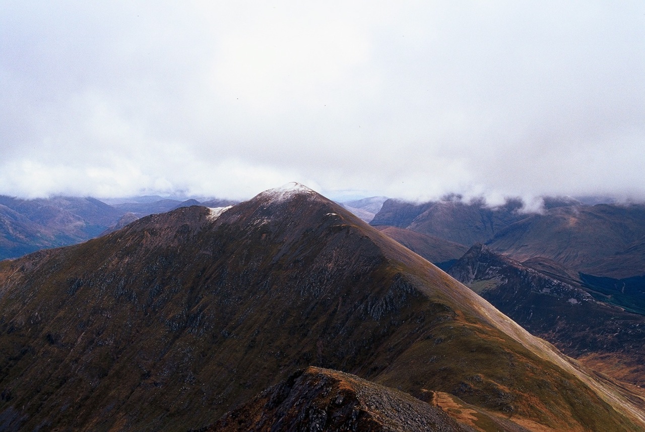
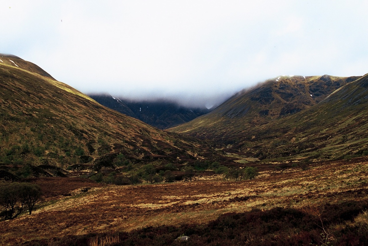
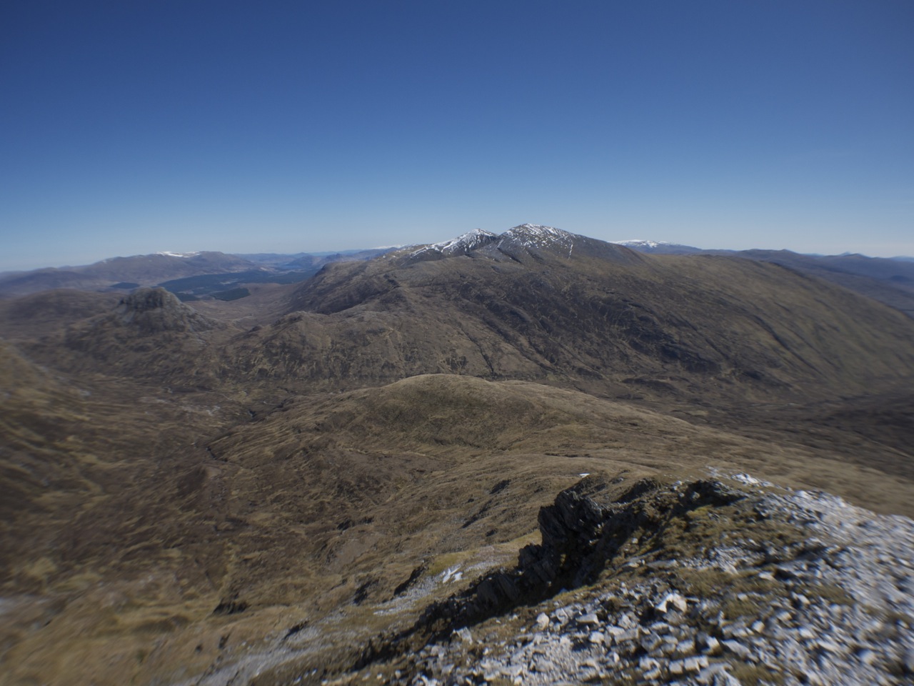
Ben Lui. The great hill of the Southern Highlands. The cradle of Scottish winter mountaineering. The symmetrical monarch of the Cononish Glen. Jokes aside this hill proved to be one of the really interesting ones even though we walked it under an almost continuously closed cover of clouds the base of which lingered at around 800 m. As the starting point we had opted for the parking of the lower station at Tyndrum. We walked along the forrest road on the low slopes of Sron nan Colan until we reached the junction with the land-rover track up Glen Cononish.

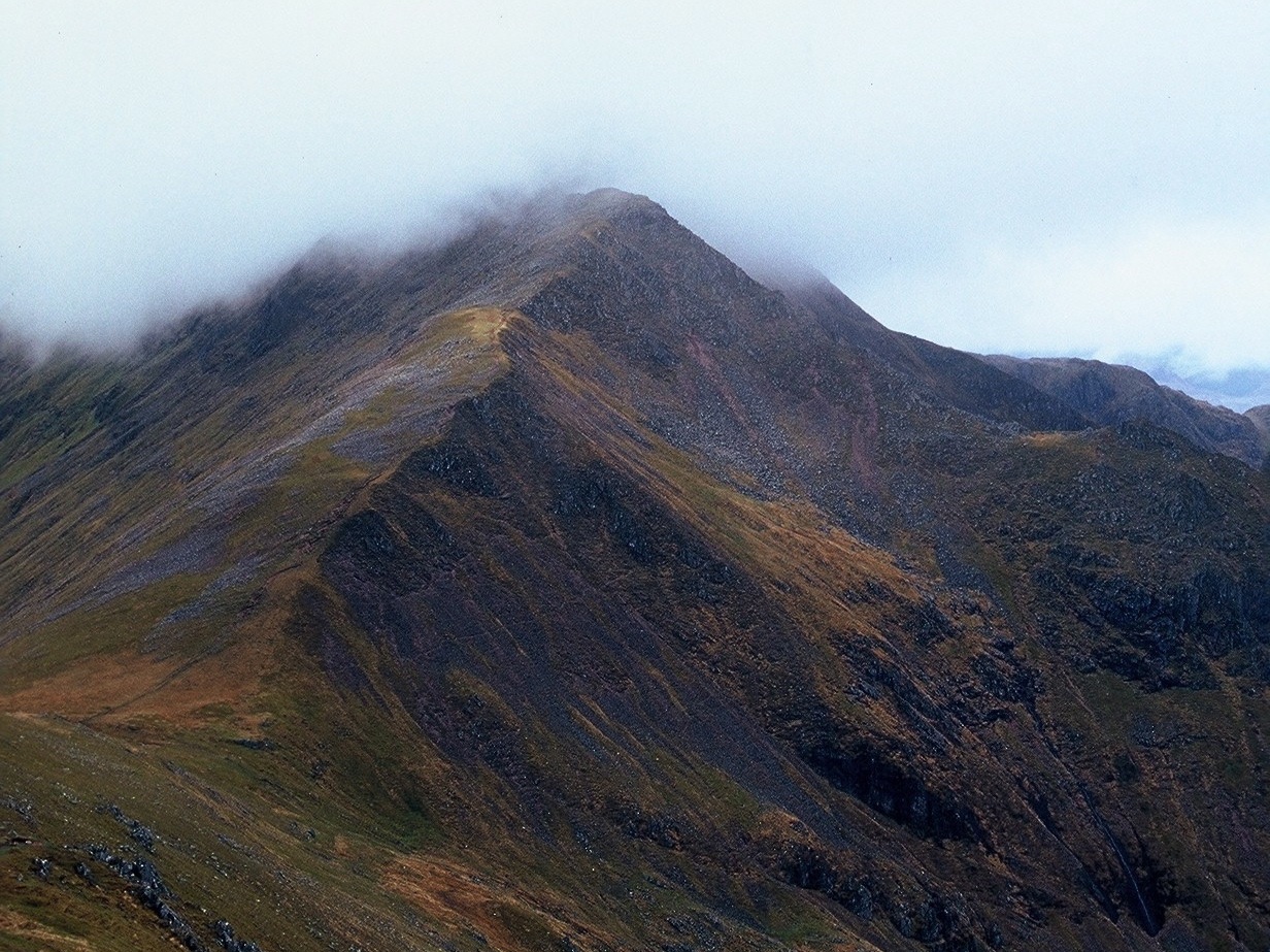
We passed the farm and continued up the glen up to the point where the land rover track turns into a path that crosses the Allt an Rund and heads up over steep ground into Coire Gaothach. Magnificent corrie even when the upper parts of Ben Lui’s ridge are not visible. We continued up the bowl of the corrie and aimed left for the point in the skyline where the rocky North-East ridge becomes really steep above Stob an Tighe Aird. The weather not being really agreeable we decided not to climb to the summt directly but rather to cross the shallow corrie further east, climb its headwall and gain the easy ridge leading up to the summit all the way from the Ben Lui/Ben Oss col.

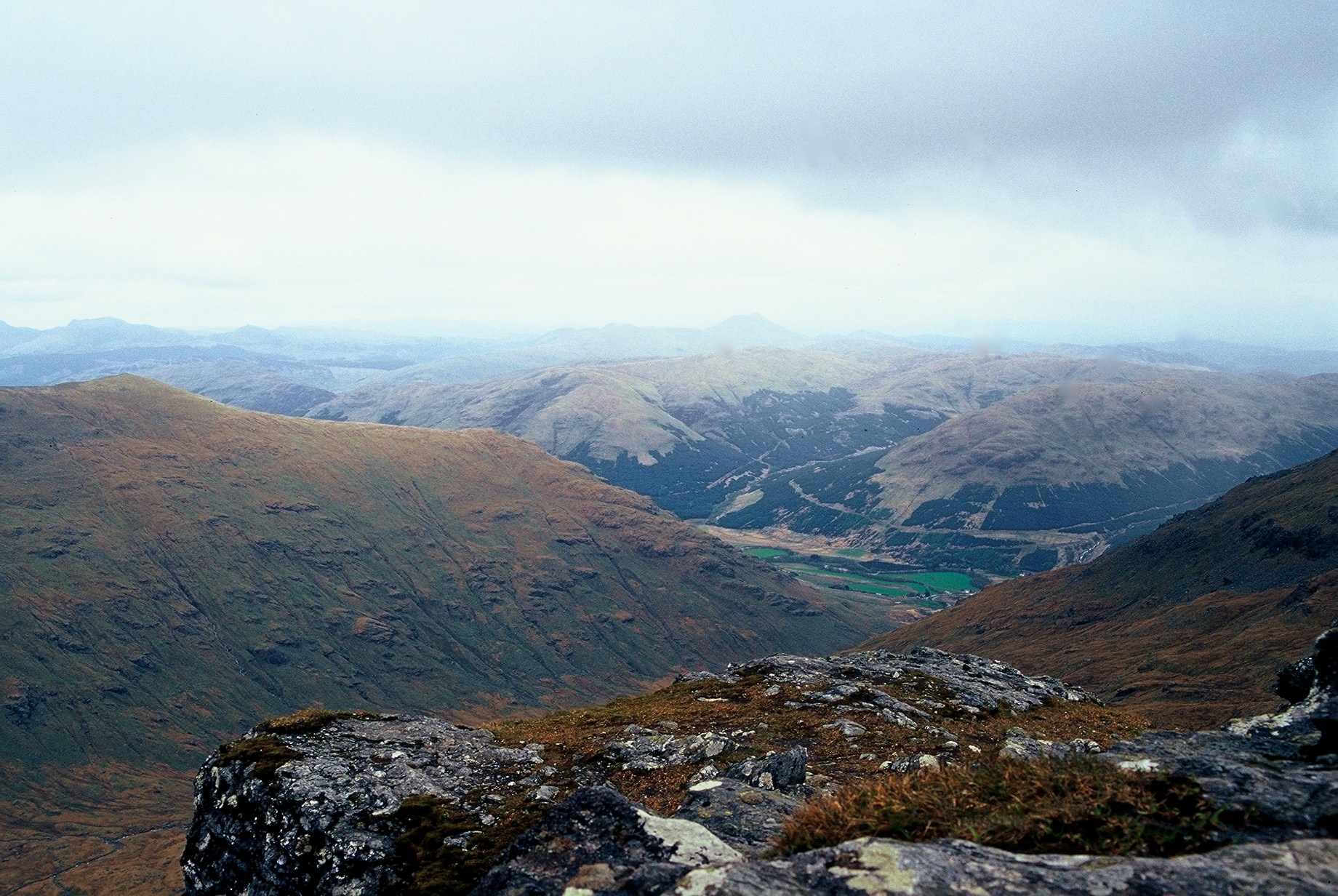
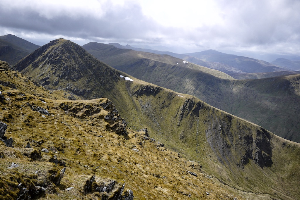
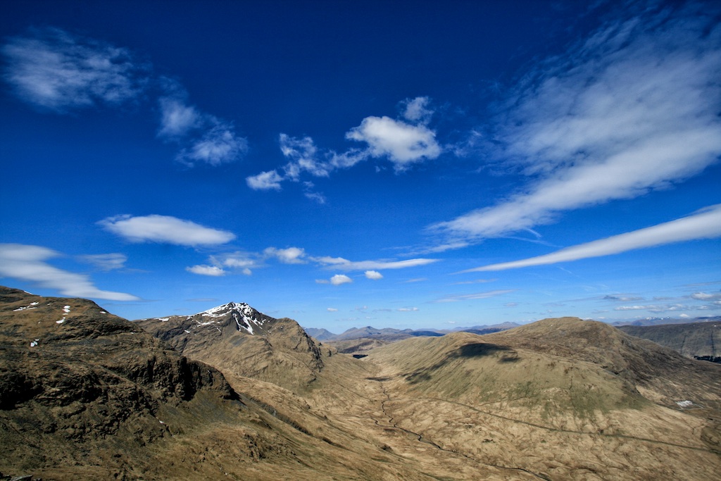
A little rain set in on the final metres before the summit but it subsided again. Sitting in the clouds at the summit cairn we had a snack and took in the few (rather vertical) views that could be had of Coire Gaothach below. We then followed the ridge to the second summit of Ben Lui and started our return walk down the north-west ridge which was steep on the first few hundred metres. Soon we reached the col before Stob Garbh and walked down the path into the corrie where the path back down to the Allt an Rund, Cononish farm and finally Tyndrum was regained. A grey day on a beautiful hill … [Read More]

2017-09-19T14:18:50+02:00May 1st, 2003|2003, 2009 - 2000, Loch Lomond to Loch Tay|

Ben Lomond

This being the first hill of a ten-day outing Frank and I reached the car park on the east shore of Loch Lomond at Rowardennan Youth Hostel by 3 p.m. We put on our gear, set off and —- missed the path behind the toilet block. Instead we followed another track which led us into thickets and plantations of young fir trees. After some plodding around we reached a clearing and regained the tourist path up Ben Lomond. From then on it was plain sailing. We quickly reached Sron Aonaich and trodded up the path to the higher regions of the Ben. Engulfed in clouds. No views. The final steepening and the following flat section of the ridge announced the arrival at the summit of Ben Lomond. Soon we reached the cairn, had a snack, took a few pictures and congratulated each other on having done one of the four geographically extreme Munros: The most southerly one. With the days work done and no views to be had we decided to head back to the car without further ado. No Ptarmigain ridge today. After just under four hours we got back to the car, threw our stuff into the boot and headed off for the B&B, meal and a few pints at Drymen. Easy first day.

2017-09-19T14:18:50+02:00May 1st, 2003|2003, 2009 - 2000, Loch Lomond to Loch Tay|

Sgorr Dhonuill

Driving to Ballachulish from Inchree where we had spent the night at a nice B&B Beinn a’Bheithir’s skyline promised an interesting walk and a fine long day on one of the hills we had been talking about and looking forward to for years. We parked the car at the start of the right of way to Glen Creran close to the school house in Ballachulish. This being a Saturday there were quite a few people on the lower slopes of Beinn Bhan. All members of a hiking club whom we met later on the main ridge.

After 15 minutes we left the track and headed up the ever steepening ground leading to the north-east ridge of Sgorr Bhan. The first 400 m were gained quickly albeit with considerable effort due to the very steep slope of grass and heather. Soon we reached the section where the ridge becomes more defined and rocky. The last 200-300 m below the summit of Sgorr Bhan were an exposed scramble in some places and required attention indeed. Real fun and very enjoyable in the nice and dry conditions of the day. Not a place I would like to be in bad weather, though. Climbing the last final scree slopes we reached the easier ground leading to the summit of Sgorr Bhan where a light snow shower greeted us at the summit.

Without stopping longer than for a short snack we headed on over the connecting ridge to Sgorr Dearg but could not get a good impression of the symmetry of this curving arc since the snow shower hid much of the beauty from our view. Then, at last, we saw the summit of Sgorr Dearg and reached the cairn soon after. From here on the view improved. The impressive east face of Sgorr Dhonnuill, the Pap of Glencoe, Bidean nam Bian and so on. The hill-walking club was catching up with us and soon we moved on heading down towards the beallach between the two munros. Down at the col another group joined the … [Read More]

2018-12-31T10:40:12+01:00May 1st, 2003|2003, 2009 - 2000, Strath Orchy to Loch Leven|

Sgorr Dhearg

Driving to Ballachulish from Inchree where we had spent the night at a nice B&B Beinn a’Bheithir’s skyline promised an interesting walk and a fine long day on one of the hills we had been talking about and looking forward to for years. We parked the car at the start of the right of way to Glen Creran close to the school house in Ballachulish. This being a Saturday there were quite a few people on the lower slopes of Beinn Bhan. All members of a hiking club whom we met later on the main ridge. After 15 minutes we left the track and headed up the ever steepening ground leading to the north-east ridge of Sgorr Bhan. The first 400 m were gained quickly albeit with considerable effort due to the very steep slope of grass and heather. Soon we reached the section where the ridge becomes more defined and rocky. The last 200-300 m below the summit of Sgorr Bhan were an exposed scramble in some places and required attention indeed. Real fun and very enjoyable in the nice and dry conditions of the day. Not a place I would like to be in bad weather, though. Climbing the last final scree slopes we reached the easier ground leading to the summit of Sgorr Bhan where a light snow shower greeted us at the summit. Without stopping longer than for a short snack we headed on over the connecting ridge to Sgorr Dearg but could not get a good impression of the symmetry of this curving arc since the snow shower hid much of the beauty from our view. Then, at last, we saw the summit of Sgorr Dearg and reached the cairn soon after. From here on the view improved. The impressive east face of Sgorr Dhonnuill, the Pap of Glencoe, Bidean nam Bian and so on. The hill-walking club was catching up with us and soon we moved on heading down towards the beallach between the two munros. Down at the col another group joined the … [Read More]

2017-09-19T14:18:50+02:00May 1st, 2003|2003, 2009 - 2000, Strath Orchy to Loch Leven|

Cruach Ardrain

Frank and I picked up Alex in Crianlarich where he had come to from Glasgow in the morning. We began the climb of Cruach Ardrain from the car park of the Forrestry Commission above the A 85. Using the forrest roads we reached the foot of the north-west ridge of the mountain, climbed up a clearing created by tree-harvesting and soon gained the top of the Grey Height. Continuing over the knobby ridge with several ups and downs we progressed to the foot of the final ascent to the summit ridge of Cruach Ardrain. Climbing steeply up the western side of the hill we reached the top and pondered the idea of including Beinn Tulaichean in the walk. But we decided against that idea and climbed the last few metres to Cruach Ardrain’s cairn. After a short break and after having taken in the views of Ben More and Stob Binnein we descended the very steep path to the col between Cruach Ardrain and Stob Garbh. The continuation over the mostly grassy north-east ridge was easy. Above the forrest we contoured around the western side of the ridge avoiding its steep and craggy final section. Through firebreaks we reached the forrest road below, crossed it and soon afterwards also crossed the Allt Coire Ardrain. From there we navigated through the forrest and reached the car park five minutes before the rain set in. Perfect timing. Good we did not bag Beinn Tulaichean. A beautiful ridge walk.

2019-02-19T12:53:37+01:00May 1st, 2003|2003, 2009 - 2000, Loch Lomond to Loch Tay|

Stob Poite Coire Ardair

Two years ago I had walked up the path in Coire Ardair in late winter. This time in May 2003 Frank and I did not see any snow on the corrie ground. We set off from Aberarder Farm, walked up the the path in the beautiful setting of Coire Ardair and reached the section of the path below the Coire Ardair cliffs of Creag Meagaidh at the lochan after an hour or so.

We had a snack and pressed ahead to the pass at the head of the corrie. Once we had reached the Window we climbed up steep pathless grass slopes in a northerly direction and then followed the path east on the stony ridge to the summit of Stob Poite Coire Ardrair. The first Munro of the day. The first Munro I ever did twice. We returned to the Window and followed the path in a south/south easterly direction up the broad shoulder of Creag Meagaidh until we reached the corrie rim above the Coire Ardair cliffs still topped by cornices. From there we continued in a south-westerly then west-south-westerly direction over the flat plateau until we reached the huge cairn preceeding the summit.

At the real summit we had a break and admired the views: Fog and clouds interrupted by short glimpses of the corries below. With the arrival of other walkers at the summit we packed our rucksacks again and headed back across the vast plateau in an easterly direction guided by occasional compass readings. We crossed the rather featureless terrain, reached Puist Coire Ardair and headed further on to Sron a’Ghoire. On this part of the ridge we were lucky enough to get some very fine views of the northern bounding ridge of Coire Ardair.

Below Sron a’Ghoire we followed a developing path along the Allt Bealach a’Ghoire to the bridge over the Allt Coire Ardair and back to the car park below Aberarder farm. A nice but – on the hill top – foggy day in the Aberarder Forrest. Beautiful hill. Good, long satisfying walk.

2001 Clouds, … [Read More]

2017-09-19T14:18:51+02:00May 1st, 2003|2003, 2009 - 2000, Glen Roy to the Monadhliath|

Stob a’Choire Mheadhoin

The Easains. Another day with a weather forecast that did not exactly extend an invitation to eager hillwalkers wanting to do a high-level tramp over exposed terrain. We set off from Fersit in the middle of the morning in glorious sunshine. We passed the dam of Loch Treig and looked at the western slopes of Stob Coire Sgriodain with water tumbling down the burns on the hillside. In no time we reached the spot where today’s path branched off and headed up the slope to reach the shoulder of the hill below Meall Cian Dearg. First glimpses of the Grey Corries in sunshine. On we pressed over Meall Cian Dearg only to discover that on the hill the weather was about to turn foul.

We trodded on over the very broad ridge and before the second stepening of the ridge was reached we put on our rain gear – only to discover here that Frank had forgotten to bring along his waterproof jacket. Oh my! Through strong winds bringing along a considerable amount of drizzle we reached the summit of Stob a’ Choire Mheadhoin fighting against the breeze which was getting stronger. In the lee of the summit cairn we rested for a short while and ate some sandwiches and drank hot tea from the flask before we continued to the col between the first munro and Stob Coire Eassin. On the descent to the col the wind got really strong and for a second I considered heading straight down NW to Coire Laire. But looking each other in the face we realized that the weather would not stop us this day. So soon we climbed up the steep slopes to the summit of Stob Coire Eassin. The summit was gained and again we rested behind the cairn. The views were not too extensive but we were content with being sheltered from the wind. So after some more tea we headed down the north-west rige of Stob Coire Eassin which was quite steep, eroded and in places composed of a … [Read More]

2017-09-19T14:18:51+02:00May 1st, 2003|2003, 2009 - 2000, Loch Linnhe to Loch Ericht|

Beinn Ghlas

The last day of the May 2003 campaign. After having suffered a set-back in the Mamores the day before, we decided that the last day would be spent on a hill which had less resistance to offer than Sgurr a’Mhaim on a showery, wintry day in May. So after having crammed our baggage into the car we set off from Fassfern and headed south for two hours reaching Loch Tay by noon. From the NTS visitor centre we walked up into the Nature Reserve, crossed the Burn of Edramucky and headed up the broad shoulder of Beinn Glas on the very well-trodden path. Further up on the hill the weather turned (moderately) foul with strong winds, considerable wind chill and some snow. After an hour and half we had reached the summit of this mountain, touched the cairn and headed back in the direction we had come from, Ben Lawers being no objective this day. Before the path drops to the Burn of Erdamucky, still on the ridge, we paused, had some tea and a sandwich and with the views getting better by the minute checked out the Tarmachan Ridge, Meall Corranaich and Meall a’Choire Leith which, taken together, could be another fine day out on these OS 51 hills. We reached the car after less than three hours. An easy Munro, ticked off as last Scottish hill of 2003. Haste ye back!!

2017-09-19T14:18:51+02:00May 1st, 2003|2003, 2009 - 2000, The River Tay to Rannoch Moor|

Creag Meagaidh

Two years ago I had walked up the path in Coire Ardair in late winter. This time in May 2003 Frank and I did not see any snow on the corrie ground. We set off from Aberarder Farm, walked up the the path in the beautiful setting of Coire Ardair and reached the section of the path below the Coire Ardair cliffs of Creag Meagaidh at the lochan after an hour or so.

We had a snack and pressed ahead to the pass at the head of the corrie. Once we had reached the Window we climbed up steep pathless grass slopes in a northerly direction and then followed the path east on the stony ridge to the summit of Stob Poite Coire Ardrair. The first Munro of the day. The first Munro I ever did twice. We returned to the Window and followed the path in a south/south easterly direction up the broad shoulder of Creag Meagaidh until we reached the corrie rim above the Coire Ardair cliffs still topped by cornices. From there we continued in a south-westerly then west-south-westerly direction over the flat plateau until we reached the huge cairn preceeding the summit.

At the real summit we had a break and admired the views: Fog and clouds interrupted by short glimpses of the corries below. With the arrival of other walkers at the summit we packed our rucksacks again and headed back across the vast plateau in an easterly direction guided by occasional compass readings. We crossed the rather featureless terrain, reached Puist Coire Ardair and headed further on to Sron a’Ghoire. On this part of the ridge we were lucky enough to get some very fine views of the northern bounding ridge of Coire Ardair.

Below Sron a’Ghoire we followed a developing path along the Allt Bealach a’Ghoire to the bridge over the Allt Coire Ardair and back to the car park below Aberarder farm. A nice but – on the hill top – foggy day in the Aberarder Forrest. Beautiful hill. Good, long satisfying walk.

2001 Clouds, spells … [Read More]

2017-09-19T14:18:51+02:00May 1st, 2003|2003, 2009 - 2000, Glen Roy to the Monadhliath|

Stob Coire an Laoigh

The Grey Corries. On a day with uncertain weather forecast we drove to Corriechoille. Sunny spells and rain showers were the BBC’s guess and this proved to be correct during the first two hours of the walk – later there was only sunshine and clouds but hardly any water from above. We parked the car at the junction where the private road to Corriechoille branches off south. We walked on this right of way past Corriechoille Farm into the direction of the forrest plantations north of the Grey Corries range. Continuing on the forrest road which roughly runs parallel to the bed of the Allt Leachdach we soon left the forrest behinds us and headed towards the highest point of this track below the craggy west face of Cruach Innse. A few hundred metres before the col we left the track and headed in a south-westerly direction up the steep lower slopes of Stob Coire na Ceannain. We paused where the steep slopes ease off and give way to the higher plateau-like grassy terrain. From there we walked to the end of the steep south east ridge, contoured around it and picked up a path heading first north than west which took us to the summit of Stob Coire na Ceannain. From this top the connecting ridge to the first Munro of the day looked interesting and entertaining indeed.

It lived up to this expectation and proved to be the most entertaining scramble of the day. Finally we got to the summit of Stob Choire Claurigh. We took a longish break there, had a snack and some tea and above all enjoyed the views. With more fun to come we then pressed on over the twisting ridge of the Grey Corries with its gentle drops in height, beautifully steep northern corries and succession of rocky tops ligned up on the way to the day’s Munro No. 2, Stob Coire an Laoigh. After about one hour of walking we reached it and sat down to have tea inside the circular shelter … [Read More]

2017-09-19T14:18:51+02:00May 1st, 2003|2003, 2009 - 2000, Loch Linnhe to Loch Ericht|
Go to Top