Beinn a’Chleibh

Many years ago when Frank and I had climbed Ben Lui the weather and the views had not been really great (in fact it had been a rather dreich day). So we had skipped the extension to Beinn a’Chleibh, then. This meant that we still had this half-day walk to do that we could slip in when it suited us. The right time came on 18 November 2014 when we needed to catch an afternoon flight out of Edinburgh and had the morning at our disposal.

From Loch Fyne where we had stayed for a long weekend we drove to Loch Awe and then onwards to Glen Lochy where we left our car in the big hikers’ parking where the tramp up Beinn a’Chleibh starts. At 0810h a.m. Frank and I crossed the River Lochy (dry-shod) using stepping stones – the weather had been rather dry the past few days! Then we walked along the left bank of the river, crept under the railway bridge over the Eas Daimh and picked up the obvious path on the right bank of the burn. For the next few hundred metres the path was fine and easy to follow. Then a tributary stream coming from the left needed to be crossed. This was a little tricky but some friendly hiker had installed a rope spanning that stream which gave us something to hold on to during the slippery crossing.

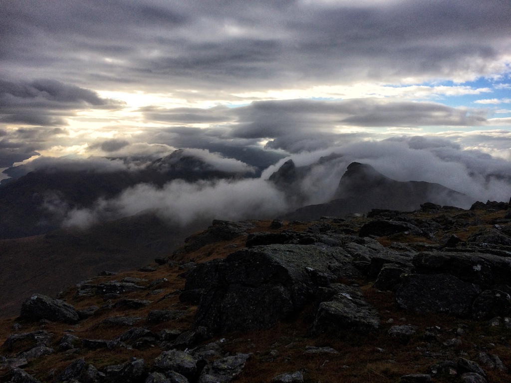
Then the real fun started. The path deteriorated into one of the worst quagmires I have ever experienced in all my years of hiking in Scotland. Bog, water holes and slushy moss. Legs sinking in almost to the knees when you hit a bad spot. All of this while ascending steeply through the forest beside the Eas Daimh. Then finally after many curses and a very tiring 45 minutes we reached the forest edge and the open grassy Fionn Choirein. Heaven! Hoorah!

The crags of Beinn a’Chleibh were obvious from there as was the way ahead towards the steep headwall of the corrie. The wooden monolith welcoming … [Read More]

2017-09-19T14:15:00+02:00November 18th, 2014|2014, 2019 - 2010, Loch Lomond to Loch Tay|

Ben Vorlich

Of the two Beinn Vorlich Munros this was the second one I had the privilege of climbing. No. 1, the Loch Earn Munro, had been my two hundredth Munro. And yes: After topping out on that one Frank and I had become increasingly single-minded and very intent on finishing off the tick list at last. That single-mindedness was also the reason why we had decided to come to Scotland in the middle of November to bag the Arrochar Alps.

On a misty Monday morning on 17 November we thus parked at the hikers’ layby opposite Ardlui Station. The rain gear came on immediately since it was cold and very damp. We followed the road to the second railway underpass and turned right to cross under the West Highland Railway Line. The path then continued uphill through grass for a few hundred metres until it reached the burn draining Coire Creagach which had a rough mountain track for ATVs high on its left bank.

This ATV track climbed very steeply into the open upper reaches of Coire Creagach. The terrain underfoot changed from grit to grass and bog but the ATV track remained easily recognizable all the way to the bealach between Stob nan Choinnch Bhacain and Beinn Vorlich.

From the bealach we followed a faint path that climbed around the first steep rise in the north-east ridge. Then we decided to gain the crest of the ridge which had some steep sections and became rockier the further up you get. There were one or two rock bands which sported some easy scrambling but which also required great care because of the wet weather and the slippery surface of the rocks underneath.

Then the North Top of Beinn Vorlich appeared before us in the fog. From there it was an easy stroll over the broad ridge to the true summit of Beinn Vorlich and its cairn where we remained engulfed in clouds, felt a strong wind chill and also had some showery rain beating down on us.

When planning the hike we had pondered using the … [Read More]

2017-09-19T14:15:00+02:00November 17th, 2014|2014, 2019 - 2010, Loch Lomond to Loch Tay|

Beinn Bhuidhe

Quite unexpectedly Frank and I had had the chance to steal away from work and other obligations in Germany to go on a long weekend of hill-walking in Scotland. The only drawback was the time of the year: Mid November. Weather-wise we expected the worst and hoped for the best. Ultimately it turned out that the weather gods were kind on us all of the four days we spent in the hills. No major downpours, not too many low clouds, not too much fog. 16 November was the best day and we had chosen to do the longest and most challenging walk that Sunday.

Beinn Bhuidhe is described as retiring, isolated and as being an “awkward customer” (Ralph Storer, The Ultimate Guide to the Munros, Volume 1: Southern Highlands). That may all be true. But it is also a hill that is approached by a long walk in on a good road and a Land Rover track in beautiful Glen Fyne.

At nine o’clock we left the parking at the head of Loch Fyne and walked past the brewery at Achdunan. The tarmac road and the nice views of the surrounding slopes made progress easy and interesting. Soon we passed through a herd of 30 highland cattle. Animals with quite impressive horns and a fair amount of curiosity. But very benign. Then after about five kilometres the bridge over the River Fyne was reached as were Glenfyne Lodge and the small assembly of houses nearby. Where the tarmac road turned right to re-cross the River Fyne we continued straight ahead on a good Land Rover track, went through a gate and soon reached Inverchorachan Bothy. Just past the bothy and outside the deer fence we stopped to drink some water, eat a Mars bar and get our bearings right. We exchanged a few words with a young couple who were also headed for Beinn Bhuidhe.

Then we turned due west following a narrow but distinct path on the right bank of the burn tumbling down from the steep hillside: The Allt na Faing. … [Read More]

2017-09-19T14:15:00+02:00November 16th, 2014|2014, 2019 - 2010, Loch Lomond to Loch Tay|

Beinn Narnain

The Arrochar Alps: What a grand name and what a nice alliteration. Not a very British choice of name, though, because calling these hills “Alps” does not exhibit the typical attitude of understatement that goes with being British. But perhaps there is a certain amount of eye-blinking irony in the name? We’ll probably never know.

It was Saturday morning, 15 November 2015. Frank and I had eaten a healthy Scottish breakfast at the Cairndow Inn, driven to Succoth, parked the car there, packed our backpacks, laced our boots, set our altimeters and crossed the A83. Then off we went towards Beinn Ime and Beinn Narnain. We had opted for the New Cobbler Path that gradually climbs into the Glen of the Allt a’ Bhalachain. The zigzags and the firm surface of the path made progress easy. Soon we crossed the Land Rover track and then reached the point where the path reaches the Allt a’ Bhalachain’s bed and turns right to climb more steeply towards a little dam or weir. There we got the first views of The Cobbler appearing from the mist and the clouds before us. A very nice hill. My thoughts went back to the time when I had climbed to its summit many years ago. That had been real fun.

The continuation towards the Bealach a’Mhaim was easy on a perfectly engineered mountain highway. I remembered that the last time I had been there together with Mike the upper section of the path had been in a very bad condition. But not now. Past the Narnain Boulders we climbed in a steady fashion. And very soon the path levelled out at about 650m. We had reached the Bealach a’Mhaim and continued across it towards Beinn Ime. The bealach and the first Munro were hidden in clouds but after a minute or so of taking the right bearing we soon reached the fence mentioned in the books, crossed it and followed the pretty obvious path up the rather featureless grassy slopes of Beinn Ime. We met a couple who … [Read More]

2018-08-31T08:40:23+02:00November 15th, 2014|2002, 2014, 2019 - 2010, Loch Lomond to Loch Tay|

Beinn Ime

The Arrochar Alps: What a grand name and what a nice alliteration. Not a very British choice of name, though, because calling these hills “Alps” does not exhibit the typical attitude of understatement that goes with being British. But perhaps there is a certain amount of eye-blinking irony in the name? We’ll probably never know.

It was Saturday morning, 15 November 2015. Frank and I had eaten a healthy Scottish breakfast at the Cairndow Inn, driven to Succoth, parked the car there, packed our backpacks, laced our boots, set our altimeters and crossed the A83. Then off we went towards Beinn Ime and Beinn Narnain. We had opted for the New Cobbler Path that gradually climbs into the Glen of the Allt a’ Bhalachain. The zigzags and the firm surface of the path made progress easy. Soon we crossed the Land Rover track and then reached the point where the path reaches the Allt a’ Bhalachain’s bed and turns right to climb more steeply towards a little dam or weir. There we got the first views of The Cobbler appearing from the mist and the clouds before us. A very nice hill. My thoughts went back to the time when I had climbed to its summit many years ago. That had been real fun.

The continuation towards the Bealach a’Mhaim was easy on a perfectly engineered mountain highway. I remembered that the last time I had been there together with Mike the upper section of the path had been in a very bad condition. But not now. Past the Narnain Boulders we climbed in a steady fashion. And very soon the path levelled out at about 650m. We had reached the Bealach a’Mhaim and continued across it towards Beinn Ime. The bealach and the first Munro were hidden in clouds but after a minute or so of taking the right bearing we soon reached the fence mentioned in the books, crossed it and followed the pretty obvious path up the rather featureless grassy slopes of Beinn Ime. We met a couple who … [Read More]

2017-09-19T14:15:00+02:00November 15th, 2014|2014, 2019 - 2010, Loch Lomond to Loch Tay|

Glas Tulaichean

We had seen these two hills when we had visited An Socach, Beinn Iutharn Mhor and Carn Bhac years before starting that long tour from Inverey. This time on a beautiful morning in May we approached these rather remote hills from the Spittal of Glenshee. We left our car at Dalmunzie Hotel of course not without having paid our parking fee at the reception. From the Hotel Frank and I and three English hill walkers and their dog walked up Glen Lochsie using the Land Rover track which first runs along left bank and then the right bank of the burn. A hundred metres before the ruins of Glenlochsie Lodge we had to wade the Glen Lochsie Burn since it carried enough water for us not being able to jump from stepping stone to stepping stone. One of the Englishmen was brave enough for the risky jump, though, and made it alright!

At the ruins the Land Rover track becomes quite steep for a while as it climbs the broad south ridge of Glas Tulaichean. Once the 800 metre contour is reached the way to the summit becomes quite obvious as the ridge levels off and the view opens up. The sun had given way to high clouds and a strong wind greeted us on the upper parts of the hill. Getting to the summit is absolutely easy since the Land Rover track runs up to the 1000m contour and the cairn is only few dozen metres higher. The summit was covered in clouds on and off.

We rested a few minutes at the cairn and then continued down the north ridge of the hill. At a height of about 900m we turned left off the ridge, crossed some boggy terrain in Gleann Mhor and the burn and picked up the path which runs along the southern flank of Mam nan Cairn. There’s a lower and an upper variant of the path, which are both quite boggy all the way to the point where they unite a few hundred metres before the … [Read More]

2017-09-19T14:15:03+02:00May 20th, 2013|2013, 2019 - 2010, Loch Lomond to Loch Tay|

Ben Vane

On 27 April 2012 Frank and I had touched down in Edinburgh on time, picked up our car at the Hertz rental counter and then set out on the drive to our first Munro of 2012: Ben Vane. We reached the public parking opposite the Inveruglas power station in the early afternoon. There we packed our rucksacks for the 14 km trip up Ben Vane. The weather was good, no rain in sight, clouds and sunshine. We walked along the A82 until we reached the road beside the Inveruglas Water.

The walk is quite scenic and after a few hundred metres of climbing the road soon levels out in Coiregrogain, a fine basin with A’Chrois and Ben Vane at its western end. At a prominent bridge over the Inveruglas Water we took a left turn and continued up a Landrover track for about 500 metres. Then, at a cairn, we left the track and embarked on the climb of Ben Vane’s steep east ridge. First on grass and then through outcrops and over bands of rocks we treaded up the increasingly steep ridge. Views became more open as height was gained.

After three quarters of the climb my stomach sent clear signs that I had eaten way to little that day. Thus my legs got wobbly due to the fast-dropping sugar level in my blood. Alas, soon we reached the summit, touched the cairn and Frank was so good to give me two of his muesli bars for sustenance. The pause at the summit was nice. It was a quiet afternoon and there was hardly any wind blowing during our 15 minutes at the summit.

Then, with the beautiful hill bagged, we retraced our steps down the east ridge back to Coiregrogain, the Inveruglas Water and the tarmac road leading back to the A82 where our faithful car was waiting for us. The gear was dumped in the car’s boot and gulps of water were guzzled from a bottle left behind barely four hours earlier. Then it was a short drive to Crianlarich, … [Read More]

2017-09-19T14:16:15+02:00April 27th, 2012|2012, 2019 - 2010, Loch Lomond to Loch Tay|

Stuc a’Chroin

The second day of our 2011 hill walking holiday started with a very short drive from the Lochearnhead Hotel to the south shore of Loch Earn. The roadside at Ardvorlich was quite busy with cars. Some of them obviously hill walkers’ cars but many of them belonged to guys with fishing rods. Well, it was a Saturday and the weather was fine. Frank and I chose the usual path up Glen Vorlich, passing Ardvorlich House first, then climbing gradually up this nice glen. Where the landrover track ends we continued up the highway/path that climbs the north-east ridge of Ben Vorlich. Steady climbing brought us to the spot/small cairn which marks the end of the return path from Stuc a’Chroin. From that point it was another 300m of climbing first steep, then moderate and then steep ground again to the summit. Reaching the west top and thus the Munro (Cord’s No 200!) gave us some time for a break and a good look around. A nice place indeed.

After ten minutes we continued our walk descending the south-west ridge to the beallach between the two hills, Beallach an Dubh Choirein. From the beallach the Prow of the Stuc is quite impressive and we looked for the path described by Storer in his Southern Highlands book. However the description he gives is obviously wrong since he speaks of the bypass path (not to be confused with the return path) being on the right of the Prow. The very steep and gritty path, however is to the left of the Prow and cimbs a very steep grassy gully before it ends on the ridge above close to the top of the Prow. From the end of the climb it was a short walk to the summit of Stuc a’Chroin and a well-deserved break by the cairn where we enjoyed the views to the south.

The return started by retracing our steps and then descending the north-west ridge to the spot where a steep path on loose ground drops into the corrie below the Beallach … [Read More]

2017-09-19T14:16:17+02:00May 14th, 2011|2011, 2019 - 2010, Loch Lomond to Loch Tay|

Ben Vorlich

The second day of our 2011 hill walking holiday started with a very short drive from the Lochearnhead Hotel to the south shore of Loch Earn. The roadside at Ardvorlich was quite busy with cars. Some of them obviously hill walkers’ cars but many of them belonged to guys with fishing rods. Well, it was a Saturday and the weather was fine. Frank and I chose the usual path up Glen Vorlich, passing Ardvorlich House first, then climbing gradually up this nice glen. Where the landrover track ends we continued up the highway/path that climbs the north-east ridge of Ben Vorlich. Steady climbing brought us to the spot/small cairn which marks the end of the return path from Stuc a’Chroin. From that point it was another 300m of climbing first steep, then moderate and then steep ground again to the summit. Reaching the west top and thus the Munro (Cord’s No 200!) gave us some time for a break and a good look around. A nice place indeed.

After ten minutes we continued our walk descending the south-west ridge to the beallach between the two hills, Beallach an Dubh Choirein. From the beallach the Prow of the Stuc is quite impressive and we looked for the path described by Storer in his Southern Highlands book. However the description he gives is obviously wrong since he speaks of the bypass path (not to be confused with the return path) being on the right of the Prow. The very steep and gritty path, however is to the left of the Prow and cimbs a very steep grassy gully before it ends on the ridge above close to the top of the Prow. From the end of the climb it was a short walk to the summit of Stuc a’Chroin and a well-deserved break by the cairn where we enjoyed the views to the south.

The return started by retracing our steps and then descending the north-west ridge to the spot where a steep path on loose ground drops into the corrie below the Beallach … [Read More]

2017-09-19T14:16:17+02:00May 14th, 2011|2011, 2019 - 2010, Loch Lomond to Loch Tay|

Beinn Tulaichean

On the first day of the 2011 hillwalking holiday in Scotland we only had the afternoon hours to do something. So we chose to try and bag Beinn Tulaichean, the rather easy Munro which basically is an outlier of Cruach Ardrain. Since we came from Edinburgh the approach via Balquhidder and Glen Lochlarig came natural.

We parked the car at the road end, packed our rucksacks, donned the rain gear and followed the signposts to Beinn Tulaichean. The weather was not too good but not too bad either and it improved considerably as the afternoon wore on. Soon the bridge over the Inverlochlarig Burn was reached. Once over the bridge we followed the track on the right-hand side of the burn for a few metres and then struck a beeline up the grassy slopes. The going was good, though the hillside is quite steep. We weaved our way through some minor rocky outcrops and picked up traces of a path higher up on the hill. Then the crest of the ridge came into view and a cairn marked the spot where the path reaches the ridge. From there it was a 10 minute stroll to the 946m summit of Beinn Tulaichean. The views were quite nice and we could pick out all the Crianlarich Munros from there during the summit break which also included a little snack and sip of water. In addition to bagging this Munro also had finally completed all Crianlarich Munros by ticking it. Well, with everything done that had to be accomplished that day we retraced our steps back to Inverlochlarig. The descent was steep but easy and since the weather stayed nice it was a good late afternoon walk in beautiful surroundings. A perfect end to a very good day.

After less than four hours we were back at the car park, dumped our stuff in the boot of the car and drove off to Lochearnhead, our hotel, a nice meal and a few pints. It’s nice when Scotland greets you so gently when you visit!


2017-09-19T14:16:17+02:00May 13th, 2011|2011, 2019 - 2010, Loch Lomond to Loch Tay|
Go to Top